Mapping out the protest sites for history
Architects document the culture and growth of Occupy Central zones

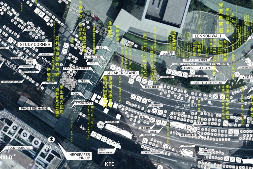
The spot where the tear gas was fired, the tent villages, the post-it note wall and study corner are all among the landmarks that will go into a mapping project aimed at documenting the growth of the Occupy Central sites.
While police are expected to clear the Admiralty site tomorrow, expatriate architects Caroline Wuethrich and Geraldine Borio, both from Switzerland, said they were drawn by the unique way the pro-democracy protesters have expressed their messages in objects and space.
"The movement has inspired so much ad hoc architecture in such a brief period of time," said Wuethrich.
"All three protest sites are self-built, rapidly organised and beautiful tools of protest, leisure, worship and infrastructure."
She said the self-made barricades, supply infrastructure and temporary institutions like cinemas and libraries inscribe themselves into the site and represent physical and metaphorical marks that are loaded with meaning.
"By showing these physical objects in context and in relation to each other, these maps reveal the way protesters have repurposed the space over time," said Wuethrich.