Advertisement
Hong Kong Observatory may issue signal No 3 as Typhoon Sarika edges closer
Storm moving across the South China Sea will bring winds and squally showers over next few days
Reading Time:1 minute
Why you can trust SCMP
0

The Hong Kong Observatory will consider issuing the No 3 signal on Monday morning as Typhoon Sarika approaches.
The Observatory said Sarika was moving across the South China Sea and expected it to bring windy weather and squally showers to the city over the next few days when combined with the effect of a northeast monsoon.
It said the No 1 signal would remain in force as Sarika maintained a distance from Hong Kong on Sunday night and Monday morning. The city’s official forecaster would consider issuing the No 3 signal during the day based on local wind conditions.
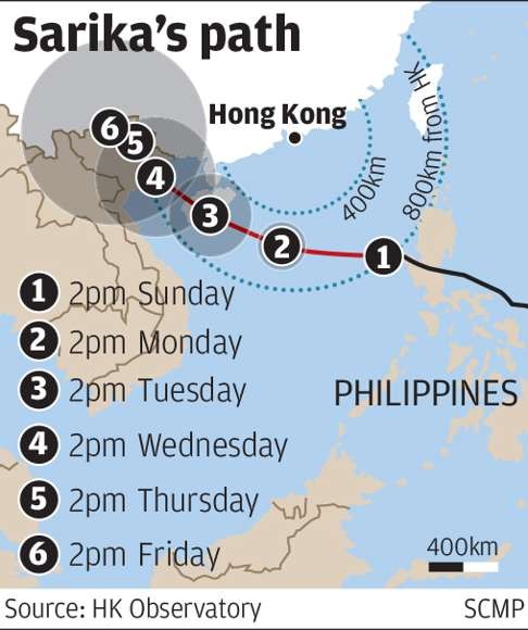
At 10pm on Sunday, Sarika was about 670km south-southeast of Hong Kong and forecast to move west or west-northwest at about 25km/h across the central part of the South China Sea. But it appeared unlikely to hit the city directly as it was predicted to travel towards Hainan Island.
Advertisement
Select Voice
Choose your listening speed
Get through articles 2x faster
1.25x
250 WPM
Slow
Average
Fast
1.25x