Google's and Apple's digital maps blur with real world
Digital maps are transforming our lives, but as we use them we add to Google's and Apple's store of data about us. Where will that lead us?
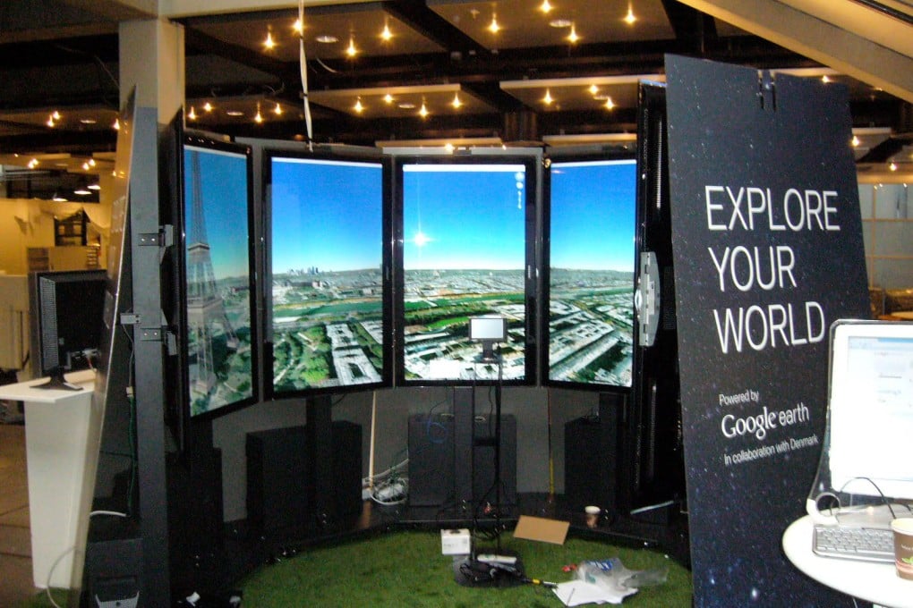
Google has a fabulous contraption called Liquid Galaxy, which it uses to amuse and impress guests at conferences for the cyber elite. It consists of eight large LCD screens, turned on their ends and arranged in a circle, with a joystick at the centre. The screens display vivid satellite imagery from Google Earth, and the joystick permits three-dimensional "flight", so that stepping inside Liquid Galaxy feels like boarding your own personal UFO, in which you can zoom from the darkness of space down to the ocean's surface, cruising low over deserts, or inspecting the tops of skyscrapers. You can swoop down to street level in Cape Town, spot ships in the Mekong river, or lose yourself in the whiteness of Antarctica.
It is a testament to the rate of change in the world of mapping, though, that Liquid Galaxy is now essentially old hat. Google has much, much bigger plans. In June it revealed that it had already started using planes to provide more detailed 3-D imagery of the world's big cities. It also unveiled the Street View Trekker, a bulky backpack with several 15-megapixel cameras protruding on a stalk, so that operatives can capture "off-road" imagery from hiking trails, narrow alleyways or the forest floor. Almost every month, new kinds of data are incorporated into Google Maps: in June, it was 3,000 kilometres of British canal towpaths, complete with bridges and locks; in July it was bike lanes. And for the first time, Google's dominance of digital mapping faces a credible threat: Apple has announced that it will no longer include Google Maps on iPhones or iPads, replacing it with its own alternative.
"I honestly think we're seeing a more profound change, for map-making, than the switch from manuscript to print in the Renaissance," says the University of London cartographic historian Professor Jerry Brotton. "That was huge. But this is bigger." The transition to print gave far more people access to maps. The transition to ubiquitous digital mapping is also transforming the roles that maps play in our lives.
Increasingly, the boundary between consulting a map and interacting with the world outside it is blurring: when Google glasses, in prototype, can project directions, or reviews of the restaurant you're looking at, directly into your visual field, what does the word "map" mean any more?
For many of us, pulling out a smartphone to find the quickest route to a meeting, or to the pub, is such a daily habit that it's hard to remember how absurdly recently it became possible. Google Maps was launched in 2005.
It became possible for users to create "mash-ups", building sites in which Google's basic maps were overlaid with other data: information about flats for rent, or the course of international warfare throughout history, or the best Indian restaurants in Glasgow.