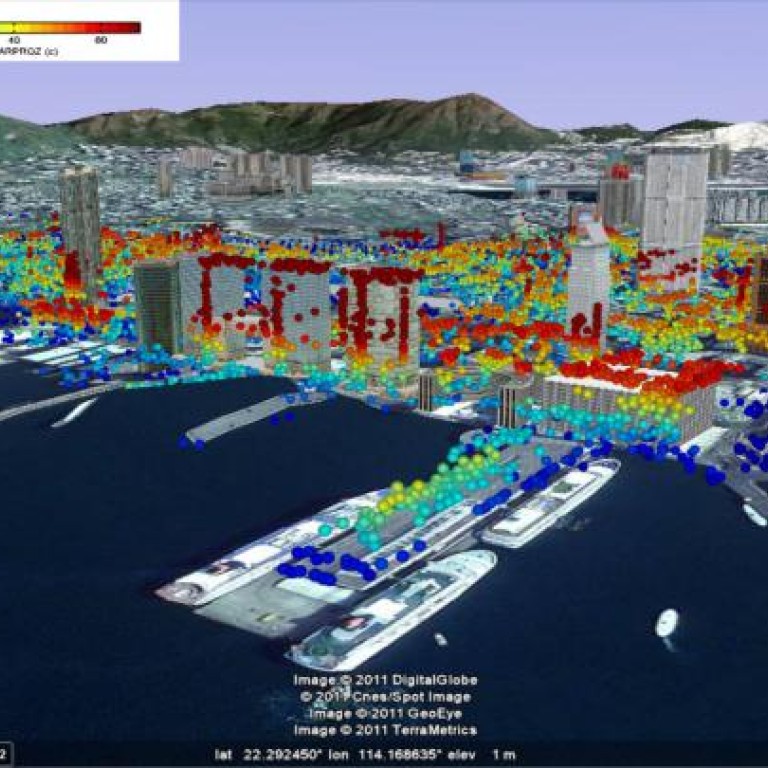
Radar researcher combines radar images to track subsidence
Radar expert has developed a program that combines satellite images to show subsurface movement which can pose a threat to buildings
A Chinese University researcher has found a way to combine snapshots taken from space at different times to show movement under the earth's surface, such as subsidence.
Now Daniele Perissin is in talks with the Hong Kong government about applying his research, which last week won a best-paper award from the scientific journal in which it was published last year.
It was just the latest award for his research, which was also recognised by European and Chinese remote-sensing bodies in July.
"The government will find it useful to detect even small movements of land, because they can analyse the cause," said the 35-year-old assistant professor at the Institute of Space and Earth Information Science at Chinese University. "Is it natural disasters like earthquakes, flooding or landslides? Or human activity like illegal dumping?"
Perissin's software makes use of a monitoring technique called interferometric synthetic aperture radar (INSAR). The program works by combining satellite radar images of the same place taken at different times.
It generates rainbow-coloured interference patterns or interferograms, in which the arrangement of coloured bands shows the direction and extent of any ground deformation. The researcher said his software was so accurate that even movements of a few millimetres can be detected from satellite data. Users can also go back in time to see how a particular area looked before.
He is working on finding the best way to combine his software with other techniques for monitoring subsidence, such as ground surveys, optical data, and ground-based radars traditionally used to ensure that construction projects are safe.
Perissin said the government had shown interest in his software, which complemented satellite observation. Hong Kong's terrain and building density made studying its surface a very challenging task, he said. But such a study was vital to ensure the stability of the city's many reclaimed areas.
The extent to which newly reclaimed land settles, and the thermal expansion of buildings, can be easily and accurately detected with Perissin's software.
A paper published last year by Perissin's colleague, Dr Chen Fulong, found no large-scale subsidence in the greater Pearl River Delta region - comprising Hong Kong, Macau and nine municipalities in Guangdong province.
"I've also shown that it is possible to detect man-made structures that are slowly moving," Perissin said, rendering it a powerful tool for the government to monitor activities like illegal dumping.
Perissin's research paper, "Time series INSAR applications over urban areas in China" was published in the .
In the paper, Perissin and his research student analysed thousands of satellite images of China. "The more images analysed, the better the quality," he said.
Since different sensors operated at different times, they used different satellites to put together composite images.
Some of the data came from European satellites like the ERS system, which came online in 1992, and the Envisat system, which has been transmitting since 2002.
But recently, the researchers have relied on data from more advanced, higher-resolution European satellites. Examples include the German Terrasar-X and the Italian Cosmo Skymed, which are used for both civil and military purposes.
"Almost all cities in China are affected by subsidence due to urbanisation, water extraction, and also the economic interests and immorality of some construction companies," Perissin said.
"That's also why my paper got awards - because I detected a lot of subsiding centres."
Shanghai and Tianjin are cities that are slowly settling. The slopes around the water reservoir of the Three Gorges Dam also showed the same trend, he said.
"If the terrain is made of materials like soft clay, and you construct a substantial building on it, it will sink, causing possible dangers. Furthermore, if you build a structure on a slope without having a deep foundation, it may slip," Perissin said.
"If groundwater is extracted - for instance, for irrigation, drinking or industry - the underground pressure will change. This may lead to compaction of the soil or surface deformation or whatnot, causing subsidence," he said. "The same thing happens if anything is excavated from underground."
Monitoring such surface movements is important for safety, so water extraction, excavations, and infrastructure planning should be regulated, Perissin said.
INSAR can also be used to study volcanoes, showing them "breathing" as surface rock is pushed from below by rising magma.
The technique is particularly useful for tropical volcanoes, where cloud cover can obscure visual observations, because the radar beam can see through clouds.
As a result, many volcanoes previously thought to be dormant are now known to be showing signs of unrest.
INSAR used to be a European speciality, though now several Asian countries were catching up, Perissin said. "More and more people are doing it now. It's a growing field," he said.
While INSAR has enormous potential, it is still a new technique that relies on frequent observations and long-duration space missions.
A series of satellites called Sentinel, which the European Space Agency plans to launch next year, is expected to provide the data for serious volcano modelling.
