New Zealand’s hiking trails offer a catalogue of wonders
Amazing vistas and challenging courses – you’ll be left breathless on two accounts on these incredible journeys
The hike had been gruelling but invigorating. A 10km ascent into New Zealand’s Mount Aspiring National Park had brought us to an overlook of Routeburn Falls, a thundering multilevel cascade of crystalline water jumping from the rock face above our heads and rushing into the deep valley below us. There we could see the Routeburn River winding through the high-shouldered Humboldt Mountains on its way to Lake Wakatipu.

Other than the danger of overextending yourself, hiking New Zealand’s abundance of trails is almost never disappointing. In fact, if you come all this way and don’t take advantage of them, you’ve truly missed out.

Richard Davies, a recreation manager for New Zealand’s Department of Conservation, says millions of dollars are pumped into the country’s park areas annually, much of it devoted to trail development and maintenance.
“It hasn’t happened by chance,” Davies says of the manicured trails. “All our staff are working on certain service standards – how much vegetation is cleared, the gradient of the track, whether the watercourses are bridged or not. We can provide a really consistent service. Wherever you go in the country you get a similar experience.”
From our hikes in the Bay of Islands on the North Island, to the southern regions of Fiordland National Park on the South Island, we found this to be true.
And there is good reason for the effort. The spectacular scenery this island nation has to offer is unsurpassed. Peter Jackson didn’t just film his J.R.R. Tolkien epics here because he didn’t want to leave his home country. The vertical landscapes, whether they anchor themselves in mountain rivers, broad lakes or the Pacific Ocean, perfectly lend themselves to fantasy.
What we were seeing often felt unreal: the knife-edge ridges on the mountains, the steep faces of which are frequently laced with waterfalls. The dense, verdant forests filled with calling birds and towering giant ferns that make you feel as if you’ve stumbled into some prehistoric world. The glittering lakes, where the water is so clear you can see the bottom until the reflection gets in your way many yards from shore.
All of these, and more, make this a country of constant surprises. And hiking is one of the best ways to see it.
There aren’t many places on the popular trails where you can head out into the wilderness and plunk your tent down when you think you’ve found a good campsite.
On many trails, you can set up camp only in designated campsites. On some, trekkers can only stay overnight in huts, many of which are rather primitive. Davies says the oldest one his agency manages was built in the 1860s by early farmers. Some, such as the one at Routeburn Falls, are relatively new and – while it is a dormitory – the bunk beds are partitioned off in a way that provides a moderate degree of privacy.

Booking of campsites and huts is required on the more popular trails. If you go during New Zealand’s summer, January to April, there is plenty of competition, especially for space in the huts. There are cancellation penalties, but you are best off booking as early as possible.
However, there are other options. On less-popular trails, huts are often available on a first-come, first-served basis and, according to Davies, you can camp wherever you find a good spot. If you venture onto some of these trails, don’t expect the carefully tended paths of the major tracks.
“We have many that are essentially just a few markers,” Davies says. “Every park or piece of land has trails like that. They tend to be not advertised as much.”
But choosing the “advanced” or “expert” category on the conservation department’s website will direct you to such trails.
We may tackle some of those next time around. But on this trip we found ourselves on some of the more popular routes.
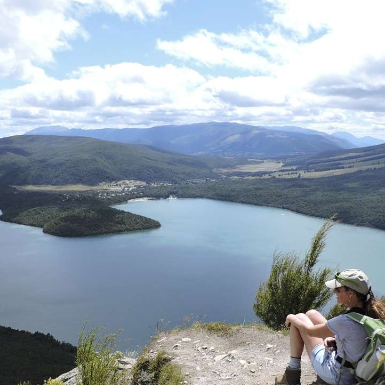
We started our South Island trip in Nelson, a quiet town but one with enough restaurants to make it interesting. After an overnight stay at the very comfortable Brettons Retreat bed and breakfast amid the vineyards of nearby Brightwater, we took a 45-minute drive to Lake Rotoiti, one of the Nelson Lakes.

Trail distances in New Zealand’s parks are typically measured in time rather than distance. We found the times to be pretty liberal estimates. The Mount Robert loop is listed at five hours. We finished in 3½ without pushing it.
Our drive for the remainder of the day took us through the Marlborough region, famous for its wineries and sauvignon blanc, and down the picturesque eastern coastline, where we saw ample numbers of surfers and sea lions, to Kaikoura. The seaside village is known for its crayfish, or spiny lobster, and excursions to see whales or swim with wild dolphins.

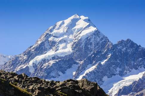
We left Lake Tekapo in the morning rain. The weather hadn’t improved much by the time we had skirted the shores of glacier-fed Lake Pukaki with its steel grey surface, and reached the trail leading into the Aoraki/Mount Cook National Park. An hour’s hike took us over roaring streams and along the base of cliff faces cut with waterfalls. When we reached the trail’s end at the milky Hooker Lake, the clouds had only slightly lifted and offered us only occasional glimpses of the shoulders of Mount Cook. Nevertheless, the scenery was stunning.

Three days later, when we were trekking along the southern end of the 48km-long Routeburn Track, we took a detour to Key Summit. There we were perched above a dramatic landscape. I know this because it said so in large letters on the sign in front of us. It was one of those sloped metal signs that depict the view before you, labelling all of the important geographic features.
To our left was Mount Christina or, to the Maori, Te Taumata o Hinepipiwai. Far below, cradled in a glacial cirque, was Lake Marian. Wrapped in a drizzling fog whiteout, we could see none of it.
Fortunately, this was the exception. Though we dealt with overcast skies on many of the days we were in New Zealand, the clouds often added to the landscape, rather than detracting from it. They were part of the experience.
But, as if bestowing a parting gift upon us, the following day was sunny. We had returned to the North Island and had started our final day with a hike on the coast directly west of Auckland, above Mercer Bay, where the coastline rivals California’s Big Sur.
At one headland stands a carving of the Maori maiden Hinerangi, who married a young chieftain but lost him at sea. Legend says she died on this spot of a broken heart, looking out to sea, hoping for the return of her love. Her face is said to appear on a nearby cliff.
I wasn’t able to pick out her features, but that hardly diminished the beauty of the place. Nor did her sad tale dampen my enthusiasm or appreciation for what we had experienced along the trails we tramped in New Zealand.
Tribune News Service

