
Sustainable Hong Kong tourism: visit the Unesco Global Geopark on a DIY trip through beautiful Double Haven to Lai Chi Wo
Take a ferry through the sheltered waters of Double Haven, past Plover Cove Reservoir and Port Island, taking in the oldest and youngest rock formations in Hong Kong to a Hakka walled village and its revived rice paddies
As the ferry to Lai Chi Wo leaves Ma Liu Shui, you can see you are within a geological feature. Tolo Harbour was formed by the sea inundating a valley carved through one of Hong Kong’s main fault lines, the 60-kilometre-long, 750-metre wide Tolo Channel Fault, extending northeast of there, and through Sha Tin Valley to near Lai Chi Kok in West Kowloon.
The Hong Kong Unesco Global Geopark has a grand title, yet is something of a curate’s egg: good in places. It comprises seven areas in eastern Hong Kong, and while the “star” rocks are the spectacular, columnar jointed volcanic tuffs of the Sai Kung Peninsula and islands, there are other sites that few but a geologist might appreciate, like Ma Shi Chau (literally Horse Poo Island) which is easily missed against the backdrop of the Pat Sin Leng range.
Last weekend the geopark was featured in the Hong Kong International Tourism Exhibition for the first time, in a bid to highlight the city on a global level, as a model for sustainable geotourism.
While this sounds impressive, sustainable tourism can be hard to pin down. One definition, offered by Unesco, is that sustainable tourism “respects both local people and the traveller, cultural heritage and the environment”.
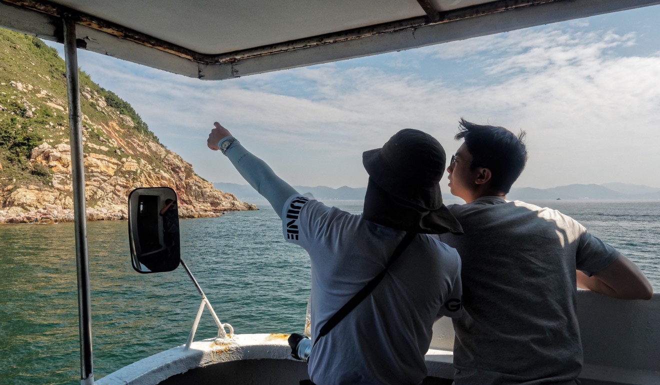
If you delight in acquiring information like this, you might enjoy one of the recommended R2G geopark tours, such as a boat trip through Tolo Harbour to Double Haven. I’ve been on one, and found it akin to a school outing for grown-ups, with guides who talked almost non-stop and, when we did land occasionally, shepherded us around using flags and megaphones. Otherwise, you might prefer a more leisurely DIY tour, hiking, or taking the ferry to Lai Chi Wo.
After Ma Shi Chau, you pass two dams of the Plover Cove Reservoir, which already seems far from the city. It is the second largest reservoir in Hong Kong, and you might wonder about the merits of a suggestion for building housing here, as included in a government survey on land supply.
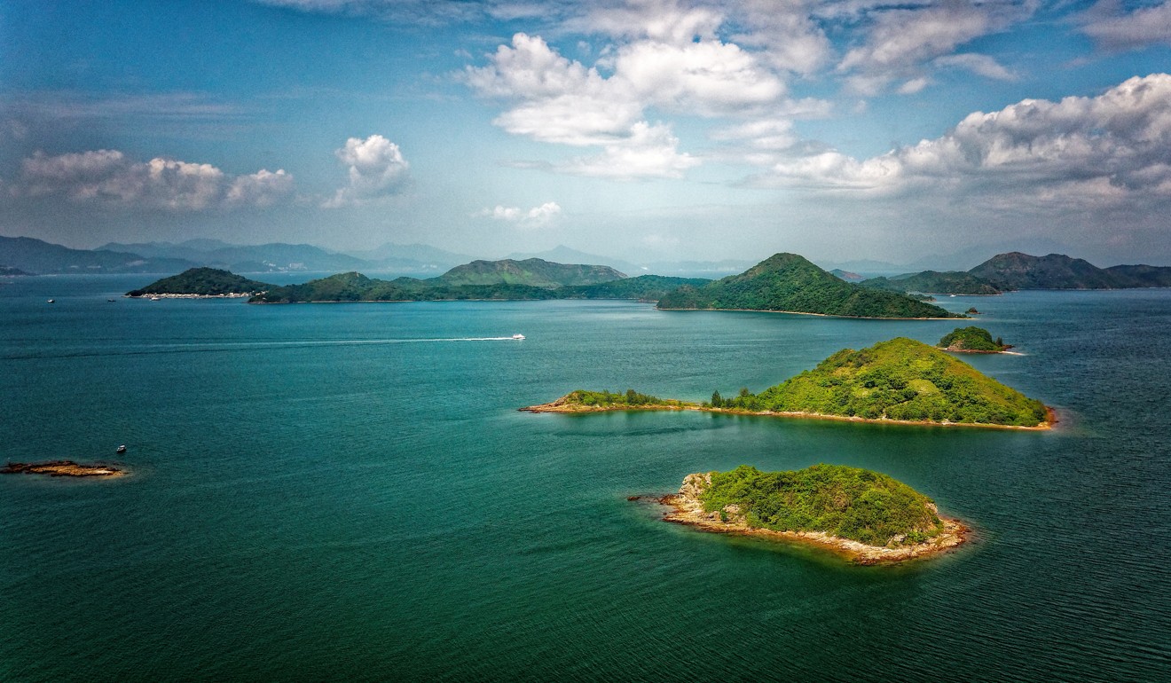
Chek Chau – Port Island – lies ahead, massive and squat, with Mirs Bay beyond. Its Chinese name, Red Island, refers to the rusty colour of iron-rich sandstones laid down by floods in a desert-like environment. These are among Hong Kong’s youngest rocks, formed after the volcanic activity that built much of the land here ceased around 140 million years ago.
Arriving at the mouth of Tolo Harbour, the ferry turns north, leaving Chek Chau to the south. Close by on the left is Bluff Head, with a cliff around 60 metres high, featuring an almost vertical band of reddish purple set amid creamy rock.
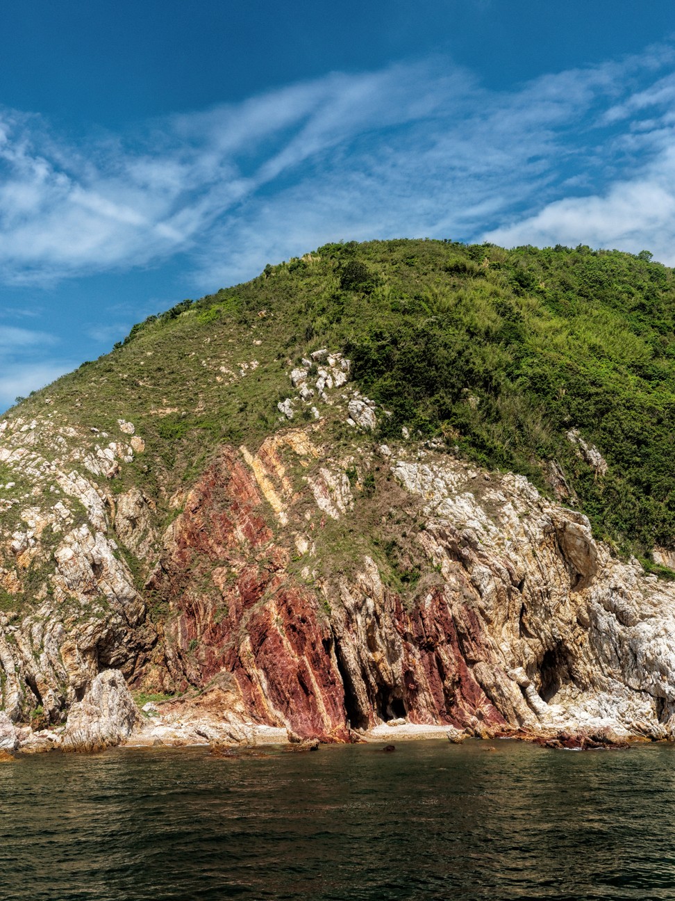
This is also mainly sandstone, but it is the oldest rock in Hong Kong, formed in deltas and rivers some 400 to 360 million years ago, and later contorted during earth movements.
The ferry slows here, affording a chance to admire and photograph the cliff, before heading towards Double Haven.
The Hongkongers giving our abandoned villages a new lease of life
This is a wonderful, remote corner of Hong Kong. Soon, the ferry nears one of the two larger islands, 2.7-kilometre long Double Island, and cruises by Wong Wan, a great beach to visit by boat or junk.
There is a channel between Double Island and Crescent Island, narrowing to around 160 metres, before the ferry enters Double Haven, which is a roughly circular expanse of calm water sheltered by islands to the north, east and southeast, and with the mainland New Territories coast to the west.
Somewhat incongruously, the northern shore of eastern Shenzhen, over the border in China, also comes into view along with high-rise housing and the cranes of Yanshan container port.
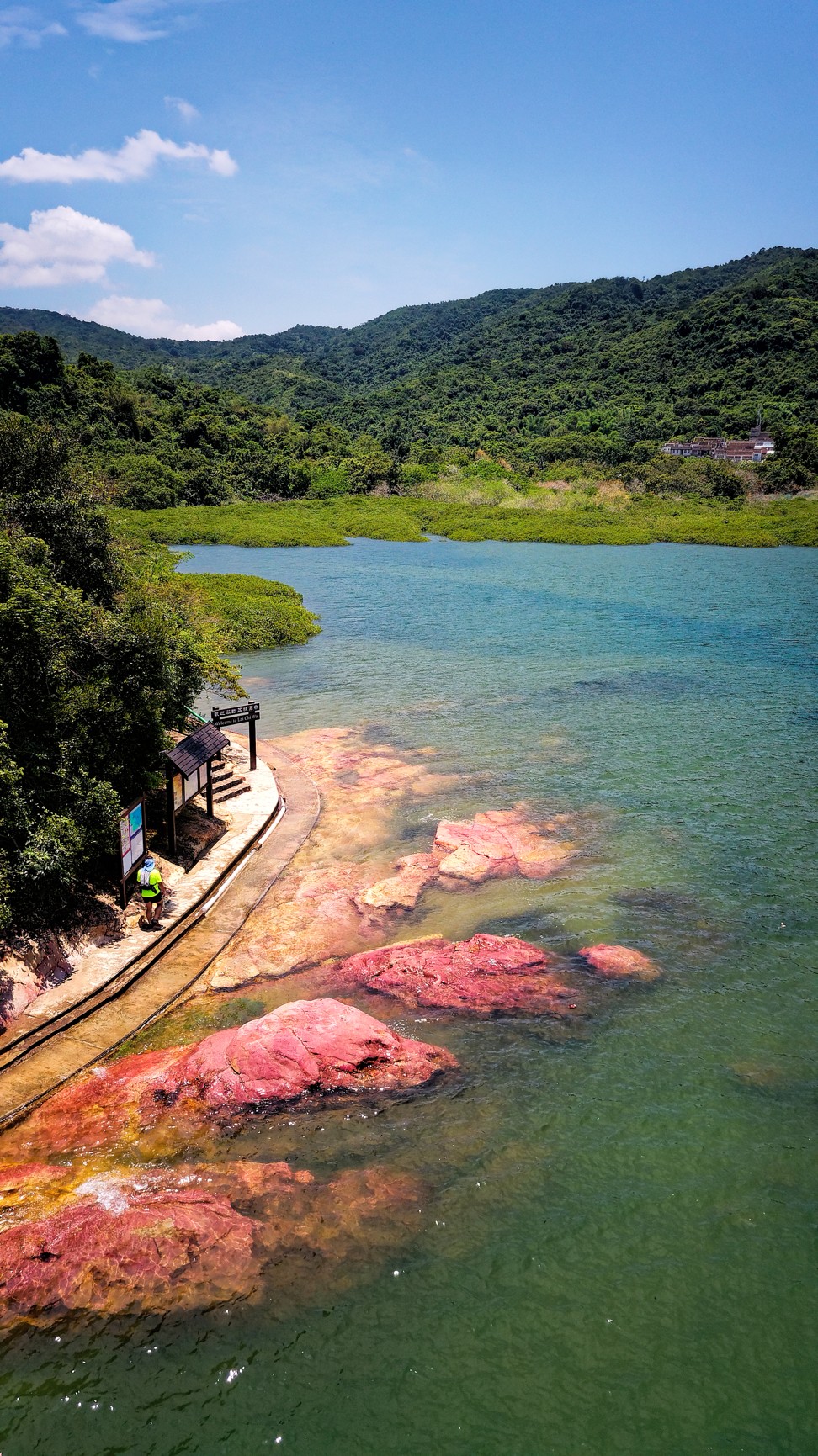
Soon, the ferry enters an inlet, and makes for journey's end, at a concrete pier by Lai Chi Wo. Woodland clothes the hillsides; the village itself is not yet in view.
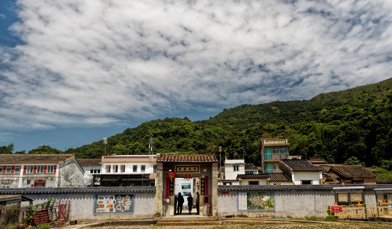
A five-minute walk from the pier, through a wood, takes you to the village. A temple and an old school are set by an open area, and the village houses are arrayed at the foot of a hillside. A wall formerly encircled the housing to guard against bandit gangs, and this has been partly restored, with an impressive gateway in the east-facing, lowest stretch of wall.
Kayaking in placid Double Haven, far from Hong Kong’s bustle and crowds
Just inside the gateway is a huge banner with photos of the geopark, near houses that have also been renovated. Friends of Unesco Hong Kong note that geoparks “give the locals a sense of pride and belonging by creating new jobs ... through geotourism” – so you might guess the renovation work arose through the Hong Kong Geopark, which was established in 2009 and gained Unesco status six years later.
There is a project to revitalise Lai Chi Wo, spearheaded by experts in various fields and the Policy for Sustainability Lab at Hong Kong University with financial support from HSBC.
While the geopark has contributed little but a modest museum to Lai Chi Wo, at least it has not proven so controversial here as on Tung Ping Chau across Mirs Bay. Soon after the establishment of the geopark, Ping Chau hostels and restaurants were closed by government officials. Angry villagers put up banners protesting against the geopark, with some even felling trees and blocking off paths.
While the Ping Chau restaurants have since reopened, Dr Yeung Ka-ming, head of Hong Kong Unesco Global Geopark for the Agriculture, Fisheries and Conservation Department, asked me to talk with islanders on his behalf, as I had often visited, making some friends there. I did try, but without success. There was a lack of trust, I was told by by one of the families operating a small restaurant there; as the government lacked a strategy for geopark tourism, and is not helping locals with restaurants and hostels.
Hong Kong Geopark retains world-class heritage ranking amid opposition from residents
Sadly, then, for now there is no restaurant at Lai Chi Wo, just a simple store selling drinks. Nor can you stay overnight in a hostel, here or anywhere in the geopark.
But you can enjoy a day trip. Walk up the north edge of the village, and you'll find a wooden boardwalk built by the department, which has also put information boards by notable trees like the Hollow Tree and the Five-fingered Camphor, which is over three metres in diameter at the base of the trunk.
In the south wall, there's a gateway to a path to rice fields established soon after the revitalisation project began in 2013. They cover an area perhaps little larger than three or four tennis courts, but are significant for reviving rice cultivation that was once widespread in Hong Kong but mostly ceased by the 1980s.
The four best sights in Hong Kong’s below-the-radar geopark and how to visit them
To explore a little further, cross a footbridge in front of the temple. There is a coastal path, passing a stand of mangrove trees. This leads to a small headland, with outcrops of red sandstone at the tideline. From here, the path turns inland, leading up and over a ridge to two hamlets in Sam A Tsuen, some 40 minutes' walk away.
From Sam A Tsuen, you may head back via a superb hike that follows a stream uphill, then leads along another stream from its headwaters to the village of Wu Kau Tang. From here there is the 20R minibus service to Tai Po Market, 5km to the southwest, or you could phone for a taxi. Otherwise, simply head back to Lai Chi Wo in time to catch the return ferry.
Getting there
The ferry to Lai Chi Wo operates on Sundays and public holidays, departing Ma Liu Shui (about three minutes' walk south of the pier) at 9am, with the return ferry leaving Lai Chi Wo at 3.30pm. The journey takes about 1½ hours, and costs HK$50 one way, HK$80 return.
td.gov.hk .
You can find information on boat tours of the geopark (mostly in Cantonese) at hkr2g.net

