Nepal’s Himalayas may be well known, but Goecha La on the Indian side of the Eastern Himalayas is barely explored in comparison. While the trek there is challenging, it offers views of 14 summits, including Kanchenjunga, the highest mountain in India. 
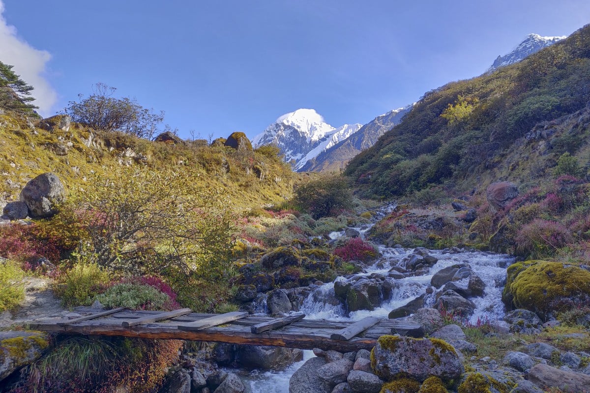
At 4,940m (16,207ft), Goecha La is a mountain pass that provides a glimpse of the Himalayas at their most pristine. It lies inside Kanchenjunga National Park, where the mountains are covered with dense forests of various green hues, waterfalls cascade from rocky ledges, exotic flowers blossom and shimmering snow-capped peaks rise in the distance. The pass looks onto the south side of Kanchenjunga. At 8,586m high, Kanchenjunga is the third highest mountain in the world (until 1852, it was presumed to be the world’s highest). The national park, spanning some 850 sq km, boasts a rich biodiversity and has been protected as a Unesco World Heritage Site since 2016, with unspoilt forests, glaciers and lakes. I was keen to do this trek as I heard it was tough. At Yuksom, the base village where the trek begins in West Sikkim, I joined a group of four tourists travelling with trekking agency Red Panda, and spent a day in the village acclimatising to the altitude (which is at 1,786m here). I had hoped to trek solo but soon learned this was not feasible as I had to carry enough food for eight days, a cooking stove, tent and sleeping bag. The trail has only very basic accommodation along the way, in log huts owned by the forest or tourism departments, and no mattresses or blankets. On the first day, after climbing a long stony trail surrounded by colourful blossoms of wildflowers for an hour, and crossing an old swinging bridge, Kanchenjunga National Park greets us, shrouded in a dense misty forest, a gigantic waterfall to our right. For the next two hours we tackle a steep ascent via a rocky and muddy trail, battered by heavy rain, with a sheer valley drop on one side. By the time we reach a shack at Sachsen, and huddle together on broken benches to eat our packed lunch, I’m exhausted. We climb along the misty valley of dense fir and pine trees bordered by mountains, listening to the rain lashing the trees and the river flowing. We camp out for the night at Bakhim, a small village at 2,638m, in a lonely two-room log hut, where a porter prepares us a delicious curry and rice on portable gas stoves in one of the rooms. I take my sleeping bag to the adjoining room and sleep, the smoke from the stove stinging my eyes. After stopping to rest and acclimatise for a day at Tshoka, at just under 3,000m, we continue on up to the next village, Dzongri. The rain shows no mercy for the next nine hours, as we take on the steepest gradient, gaining another 1,000m over 7km. My feet slip while jumping on stones, walking through water flows or balancing steps on wooden trunks used as bridges. The fog and thick dark clouds keep us from enjoying the mountain views we have come to see. At Dzongri (3,970m), we take a day off for acclimatisation. Instead of trekking to its pass, I opt for a walk to a brightly coloured small monastery near the lake, where Buddhist flags flutter. The next day, lush green meadows and alpine forests of juniper trees distract me from the six-hour scramble through slippery, muddy, loose boulders to Thansing. Here, clear skies finally bless us with a dazzling view of snow-capped Kanchenjunga, along with Mount Pandim, Mount Kabru and Mount Narsing. The snow-capped mountains on one side, intrepid rugged mountain faces on the other, lush green meadows spread in between them, and Prek Chu river flowing in full force undo all the hardships we have faced till now. Colourful rhododendron blossoms dominate the meadows here in spring. The majestic scenery accompanies us all the way to Samiti Lake (4,200m), but the tranquil surface of its crystal clear waters is soon broken by sudden rain. The ensuing downpour is so heavy we are forced to abandon the ascent and start our return to base, even though the Goecha La pass is only a further three hours’ hike away. It is a letdown, but at least we got some stunning views along the way. Half of the trekkers who attempted the journey to Goecha La in the first half of October this year could not reach the pass due to heavy rain. Generally, rain stops by mid-September and trekkers can reach Goecha La without problems. Getting there: The nearest airport is Bagdogra Airport in Siliguri city in West Bengal, India. It takes seven to eight hours to reach Yuksom (153km) by road. Set off from Siliguri in the morning to avoid travelling at night. If you go: The trek is open during the dry season from September to November and March to May. Foreigners need to get permits, which can be arranged through your government-registered trekking agency. Indians also need permits but they can obtain them from the forest check post at Yuksom. Before you go: This is a physically demanding trek, and you should do some heavy cardio training beforehand. Many trekkers take altitude sickness medicine such as Diamox. The best way to help acclimatise yourself is to take it easy, and allow enough time between stops for your body to adapt. If you start feeling dizzy, breathless or any other symptoms of acute mountain sickness, descend to a lower altitude as quickly as possible.