Laos farmers cling to a way of life that’s vanishing as developer drains marsh they rely on for water
Sustainability

As the sun begins to set in Vientiane, herds of motorbikes, SUVs and luxury trucks approach That Luang Lake, located on the Laos capital’s periphery, constructed within the That Luang Marsh, one of the city’s last remaining wetlands.

In the past few years, the circular lake has become an important public space for a growing middle class, in a city dominated by exclusive private spaces.

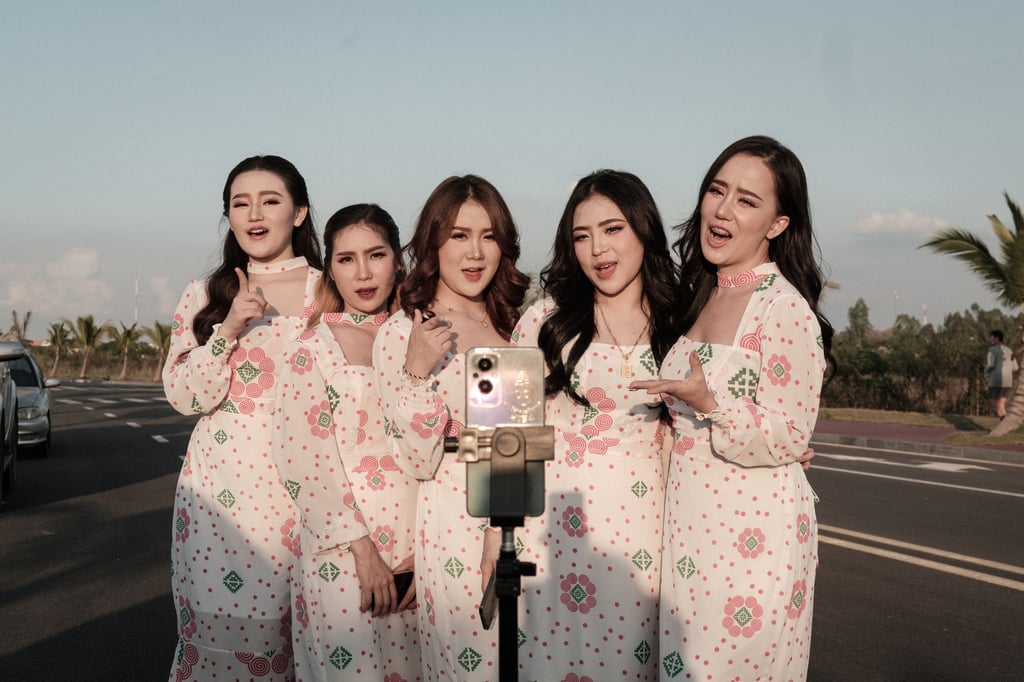
Here, locals jog and exercise on the lake’s banks, influencers shoot promotional videos and young couples snatch intimate moments.

This beloved water feature is part of a much larger investment, the That Luang Lake Specific Economic Zone (SEZ), developed by the Shanghai-based Wanfeng Real Estate Group, which promotes the project as being part of China’s Belt and Road Initiative.
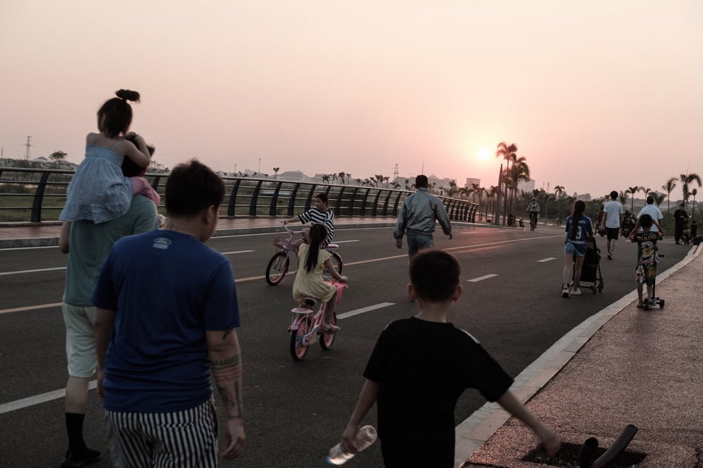
Families gather around That Luang artificial lake on the outskirts of Vientiane for a sunset stroll and exercise. The lake has become an important public space for the Laos capital’s growing middle class. Photo: Nicholas Bosoni
Influencers shoot a live video on TikTok beside That Luang artificial lake. Photo: Nicholas Bosoni
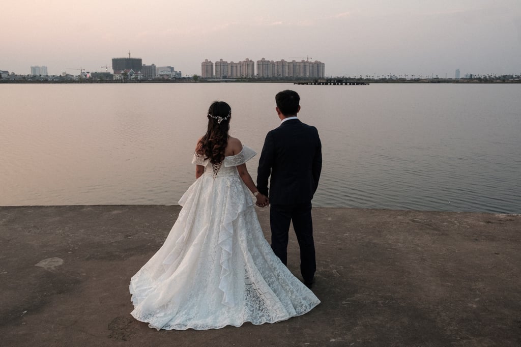
A couple stare at the artificial lake within the That Luang Lake SEZ on their wedding day. The lakeside has become a popular spot for wedding photo shoots. Photo: Nicholas Bosoni

In 2012 – a year before the initiative came into existence – the Laotian government granted Wanfeng Group a 365-hectare (900-acre) concession of state land for a period of 99 years, as part of its policy of “Turning Land into Capital”.

Wanfeng Group has already constructed a set of high-rise condominiums that foreigners can now buy thanks to a 2019 amendment to the Land Law, and the developer plans to expand amenities within the zone by attracting other investors to build shopping centres, hotels, business towers and residences.

High-rise condominiums and hotels inside the That Luang Lake SEZ. Thanks to a 2019 amendment to the Land Law, foreigners are now able to own non-landed property in Laos. Photo: Nicholas Bosoni
A sign at a construction site inside That Luang SEZ. The developer plans to expand amenities within the zone by attracting other investors to build shopping centres, hotels, office towers and residential areas. Photo: Nicholas Bosoni

Although the public has come to accept and make use of the transformed wetland, when an earlier project was announced in 2007, in which the government planned to grant 80 per cent of the wetland’s 2,000 hectares to a different Chinese company, the legitimacy of such a project came into question after the public learned that the land concession was part of a “marsh for stadium” deal.

The land had been granted in exchange for a US$100 million loan from the China Development Bank to the Laotian government, for the construction of a national stadium to be used for the 2009 Southeast Asian Games, hosted in Laos for the first time.

Additionally, rumours circulated that the development would become exclusively for meuang chin (Chinatown in Lao), the likes of which Vientiane had never seen, hosting 50,000 Chinese families.

A diorama on display at the Qube Hotel, in one of That Luang Lake SEZ’s high-rise buildings, projects the future of the area. Photo: Nicholas Bosoni

Ultimately, that project proved too controversial, among government officials as well as the public, and was moved further outside the city. The SEZ plan put forth by the Wanfeng Group was intended to address critiques of this earlier project.

Not only was it much smaller, but the government and developer emphasised its openness to the Laotian public.

It would not be gated, and Laotian businesses were welcome to invest in real estate projects or, in the meantime, set up temporary restaurants and food stalls until more permanent businesses could be established.

A house to be soon torn down to make space for a road connecting the That Luang Lake SEZ to other parts of Vientiane. Photo: Nicholas Bosoni
Pha That Luang, a national symbol of Laos. The 45-metre-high, gold-covered Buddhist stupa is near the That Luang Marsh. Photo: Nicholas Bosoni

Despite the downsizing of the project, the SEZ has affected the wetland ecology and livelihoods of residents who depend on it.

Water from the Mekong River flows northwards, and the wetlands act like a sponge, collecting run-off during heavy rains and flooding. Residents have long treated the area as a natural common, fishing and collecting snails, crabs and aquatic vegetables.

Many residents also own paddy rice fields along the periphery: aided by irrigation infrastructure developed by the socialist government since the 1980s, with assistance from inter­national donors, farmers were able to grow rice during the wet and dry seasons, giving them a decent income.

A view of That Luang artificial lake from the 15th floor of the Qube Hotel. Photo: Nicholas Bosoni
A fisherman retracts his net under the monsoon rain from a canal at the boundary of the That Luang SEZ. Photo: Nicholas Bosoni

As such things so often go, these social ecologies have been displaced by the SEZ, with many farmers dispossessed of their lands and compensated at low rates.

To ensure that the land would be dry enough for construction and not flooded during the rainy season, the centre of the wetland was dredged to create a deep canal, channelling the water away from the land to the sides and towards the artificial lake.

Ai Seng, a young rice farmer living on the eastern, less urbanised periphery of the marsh, was initially relieved that his paddy field had not fallen within the project zone and that he was able to retain his land rights.

A farmer and his cattle at the boundaries of the That Luang Lake SEZ. Farmers continue to raise their cattle, often ignoring restrictions. Photo: Nicholas Bosoni
A farmer guides his goats back to their barn after sunset at That Luang Marsh. Photo: Nicholas Bosoni

But he was dismayed when district officials started dismantling irrigation pumps that he had used to water his field during the dry season – part of the reconfiguration of the area’s water flow as “meuang chin can’t be built unless the water is drained”.

Double-season rice crops in this formerly fertile area was no longer a viable option for Ai Seng, or his neighbouring farmers.

As the flow of water through the marsh became constricted to engineered channels, the areas where aquatic life could be found had severely diminished.

A farmer looks out at his livestock grazing on That Luang Marsh, just outside the boundaries of the SEZ. Deeds sold on drained land encouraged farmers to sell their properties. Photo: Nicholas Bosoni
A farmer and his cattle warm up around a fire after sundown, beside a water channel that sets the boundary of the That Luang Lake SEZ. Photo: Nicholas Bosoni

Deeds sold on drained land encouraged farmers to speculate upon and sell their properties. Plots near Ai Seng’s had begun fetching the high prices seen in other parts of the city, up to US$300 (HK$2,350) per square metre.

As the SEZ project and adjacent real-estate development advance, the That Luang Marsh is in the midst of a transformation.

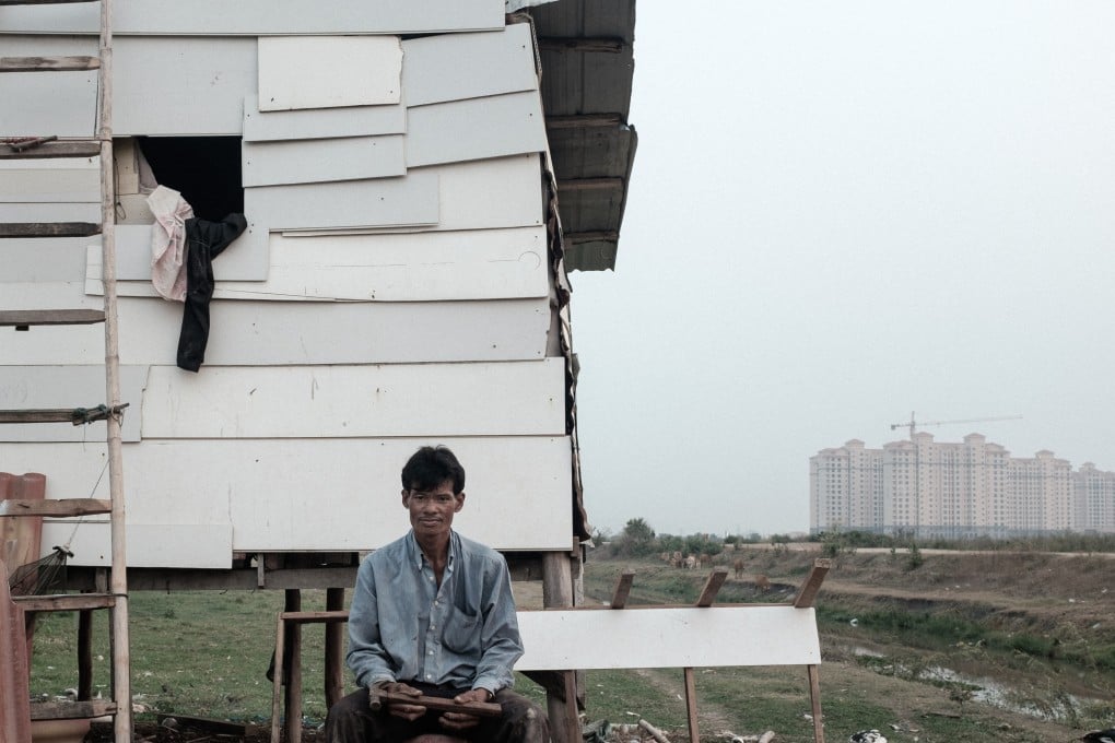
Next to the artificial lake, farmers continue to raise cattle, ignoring the boundaries of the zone despite restrictions on grazing inside it, their houses dotted through­out the construction zones.

Text by Miles Kenney-Lazar and Wanjing Kelly Chen

Post
Advertisement