Advertisement
Advertisement
Science
Get more with myNEWS
A personalised news feed of stories that matter to you
Learn more
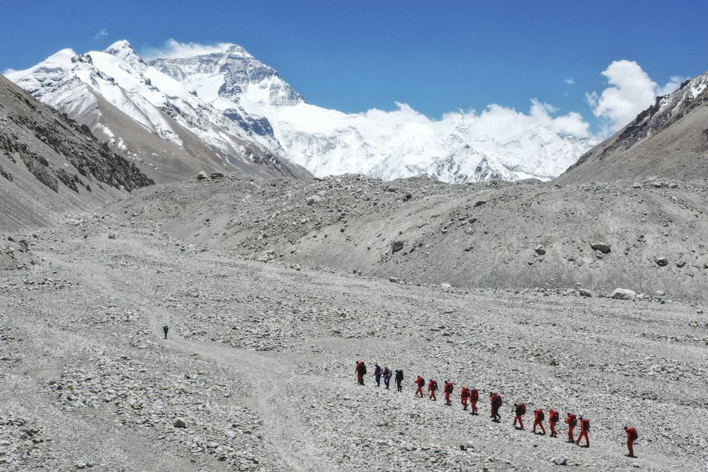
Chinese surveyors continue their ascent towards the summit of Mount Everest this month. Photo: AP

How tall is Mount Everest? China set to go the extra mile to remeasure it

  • 8,844 metres (29,017ft) was China’s previous measurement, while Nepal has said it is 4 metres higher
  • Chinese team camped 1,800 metres from the summit and will try to complete climb on Wednesday
Science
Chinese surveyors and climbers plan to scale the summit of Mount Everest on Wednesday in the latest attempt to measure the precise height of the world’s tallest mountain.

The country’s measurement of the peak as part of a comprehensive scientific survey could improve further on its previous measurement of 8,844.43 metres (29,017.2 feet), made in 2005.

The 12-strong expedition team reached a camp at 7,028 metres on Sunday, a little more than 1,800 metres from the summit, Chinese state news agency Xinhua said on Monday.

Severe weather has scuppered two previous attempts to reach the top this month, the second of them last Friday.

01:05

China sends surveyors to top of Mount Everest in a bid to measure the world’s tallest mountain

China sends surveyors to top of Mount Everest in a bid to measure the world’s tallest mountain

A joint workshop is to be held by China and Nepal – which has conducted its own measurements of Everest since 2017 – to discuss data collected by each and jointly determine the mountain’s true height, the Nepalese embassy told the South China Morning Post.

Everest, known as Sagarmatha in Nepal and Qomolangma in Tibet, lies in the Himalayas on the Nepal-China border. The two countries have long disputed whether measurements of the mountain should include its snowcap or be limited to the rock base.

China denies claim it changed official height of Mount Everest

In 2005, a Chinese expedition measured the height at 8,844.43 metres, excluding snowfall. That was declared by China to be the most accurate measurement to date.

Nepal has long held that Everest’s snowcap should be included, putting the iconic peak at 8,848 metres, a height that is widely accepted.

01:36

Chinese engineers from Huawei, China Mobile build world’s highest 5G base station on Mount Everest

Chinese engineers from Huawei, China Mobile build world’s highest 5G base station on Mount Everest

However, geologists believe the snowcap may have shrunk by several centimetres after a magnitude 8.1 earthquake struck in 2015. Changing wind speeds are also believed to have had an effect.

Following a state visit to Nepal by China’s President Xi Jinping last October, the two countries agreed to jointly announce the height of Everest, recognising the peak as “an eternal symbol of the friendship between the two countries”.

Monday was also the 60th anniversary of China’s first successful ascent of Everest – also the world’s first from the Chinese side to the north.

Huawei, China’s mobile carriers bring 5G communications to Mount Everest

China has previously conducted six large-scale science surveys and two height measurements of Mount Everest. Advances in measurement technology and mountaineering are expected to produce more precise results this time than in 2005.

The present mission has used the BeiDou navigation satellite system, China’s rival to the US-owned Global Positioning System.

Aerial gravity technology is being used to improve measurement accuracy, along with three-dimensional technology to provide a picture of the mountain’s natural resources, state media has reported.

As well as the summit, the team plans to take measurements at six other points, all above 5,200 metres.

This article appeared in the South China Morning Post print edition as: Chinese team to go extra mile in measuring true height of Mount Everest
Post