
China launches high-resolution imaging satellite to service civilian users
The Gaofen-3 can provide all-weather images day or night

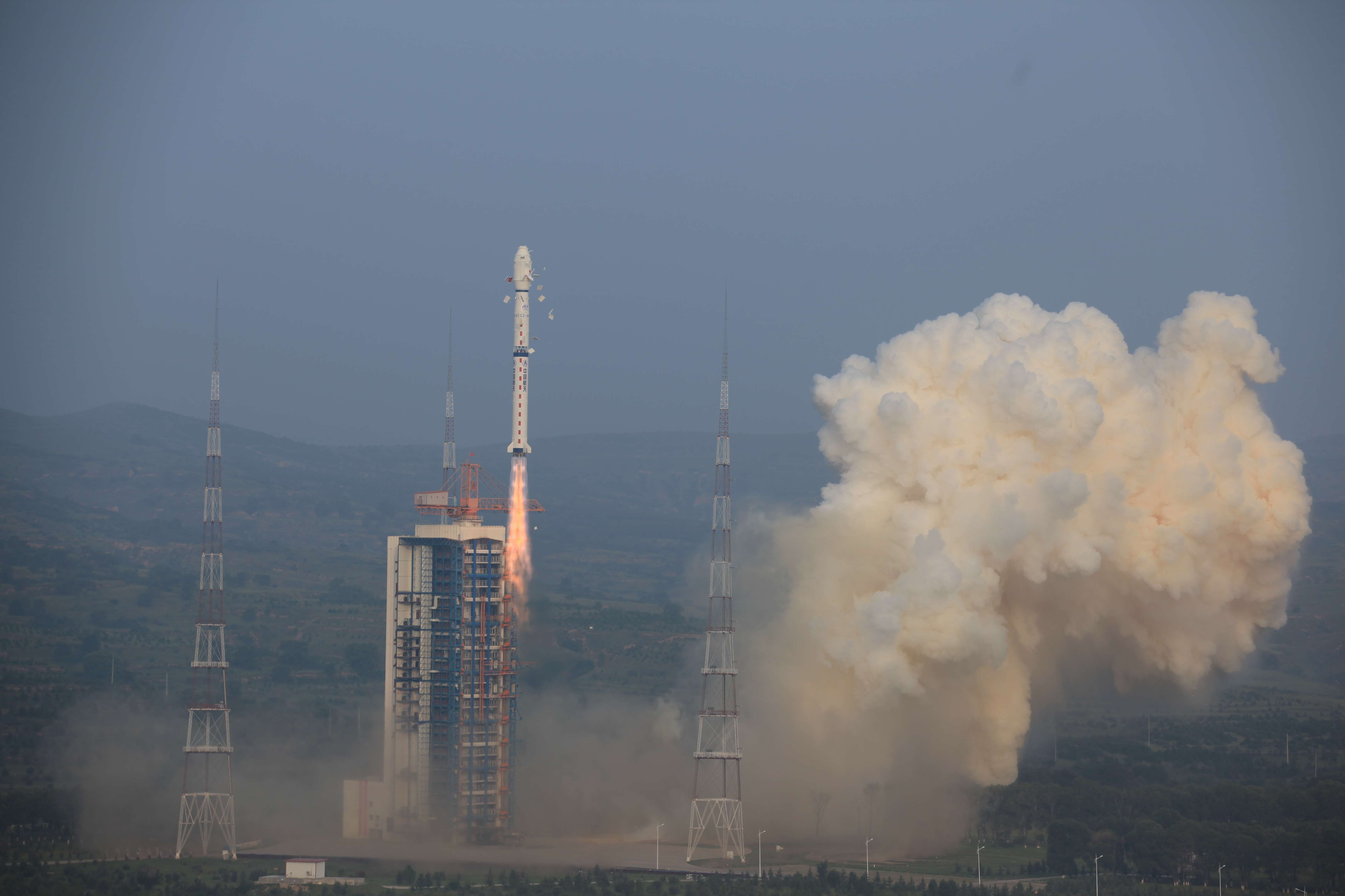
China launched the Gaofen-3, an earth observation satellite carrying the nation’s most powerful space-based radar on Wednesday.
The satellite, which is capable of penetrating clouds and even the ground to monitor areas of interest at up to one metre resolution was launched aboard a Long March 4C rocket from the Taiyuan Satellite Launch Centre in Shanxi province. The synthetic aperture radar, or SAR, on the Gaofen-3 emits powerful electromagnetic microwaves to its target area and generates high resolution images from the waves as they bounce back from the surface or interior of the target. The Gaofen-3’s antennas measure 18 metres, longer than any other Chinese satellite.
According to state media, it would be the first Chinese satellite to provide civilian users with sharp satellite images day and night, either on land or sea, under all weather conditions including rain, haze, smog and dust storms, as it works independently of natural light and heat.
It would be used for advance warning of disasters, weather forecasting, water resource assessment and monitoring of maritime rights.
The Gaofen-3 marked a “small but important step” in China’s long march to become a space power, said professor Wu Shunjun, a radar technology expert at the National Lab of Radar Signal Processing in Xidian University, Xian.
The SAR instrument use domestic technology to allow the satellite to search for targets of interest in a large area at high speed. Once locking onto a target, it could immediately shift to scrutiny mode for non-stop, close observations at high resolution for more than an hour during a fly-by.
The Gaofen- 3 has 12 different modes, each with hardware and software settings fine-tuned for specific tasks. In comparison, the PAZ satellite, to be launched by the European Space Agency later this year to supply images at similar resolution, only has three modes.
Thus, the Gaofen-3 would “serve many the different needs of many different users,” Wu told the South China Morning Post.
China had previously launched many SAR satellites, some that probably provided higher resolution, but most were reserved for military or government reconnaissance purposes including tracking suspicious vehicles in areas of unrest in Xinjiang or monitoring vessels in disputed waters in the South China Sea.
Civilian users such as research institutes studying the environment or sea level increases caused by climate change had to rely on images provided by foreign satellite service companies.
Liu Jianqiang, deputy director of the National Satellite Ocean Application Service centre in Beijing, told Xinhua in 2014 that the search for the missing MH370 aircraft would have been easier if searchers had the Gaofen-3, which was then still under development at the China Academy of Space Technology.
Plane debris floating on the surface of the ocean was always on the move and often obscured by waves and weather and therefore impossible to spot with conventional optical sensors on satellites at night, he said.
China would need at least three satellites like the Gaofen-3 in space to keep a constant eye on a sensitive area in the world’s oceans because the width of a single satellite’s scanning band was limited, and the radar could only light on an area during its fly-by, Gao said.
The Gaofen-3 was expected to be in service for eight years, nearly twice as long as other Gaofen series earth observation satellites operating in lower earth orbits, where drag was considerable due to the close proximity to the earth’s atmosphere.
The Gaofen project, also known as the China High-definition Earth Observation System, intends to establish a large network of earth observation instruments by 2020 for real time, all-weather, global surveillance on various platforms including satellites, stratospheric airships and planes.
