Chinese scientists hail space radar breakthrough
- Researchers at the National Defence Technology University say their laser imaging technology can identify small objects in space with unprecedented accuracy
- The scientists say it could be used to guide laser beams removing small pieces of hazardous space debris
A team of Chinese military scientists say they have achieved a breakthrough in laser imaging technology that will allow ground stations to identify and track a target in space with unprecedented accuracy.
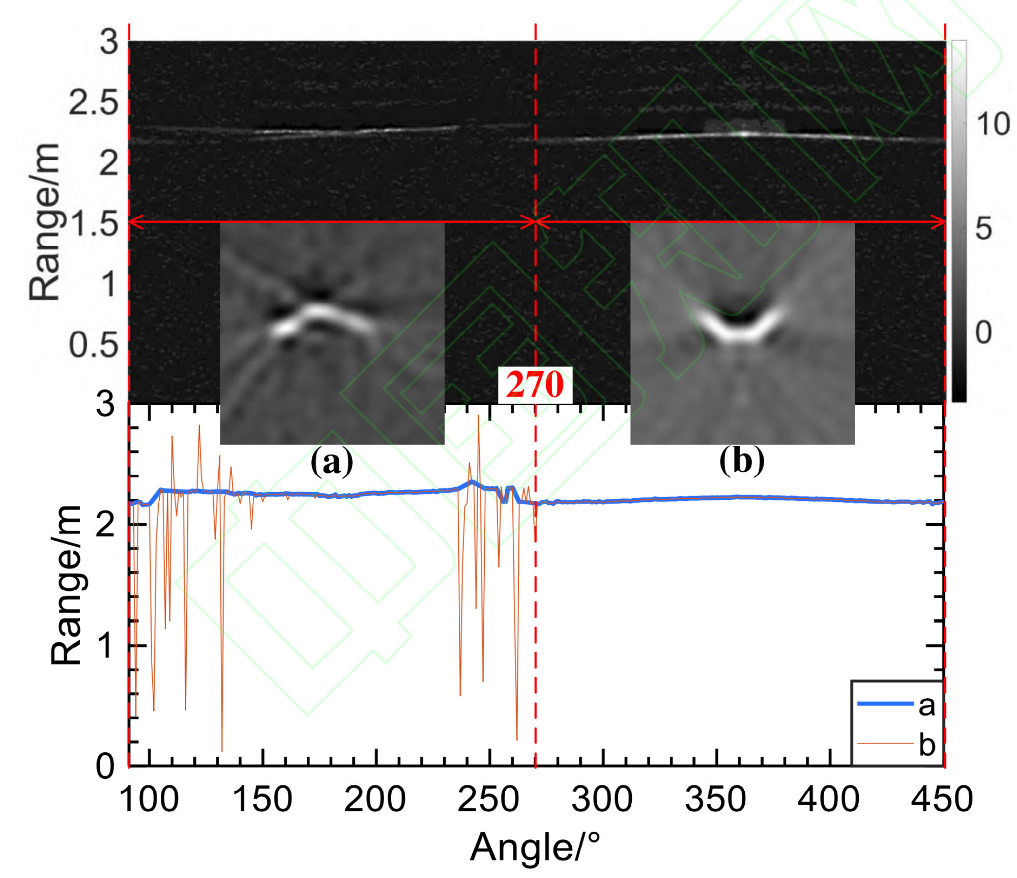
The results suggest that the radar, developed by Professor Han Fei at the National University of Defence Technology in Anhui province, can take images of a thumb sized object in near-Earth orbit with a resolution of up to 3 millimetres (0.1 inches).
This accuracy is two orders of magnitude higher than the best results achieved by similar devices in the United States and other Western countries, according to the researchers.

The technology could also help guide ground-based laser beams to remove small pieces of space debris that threaten satellites and spacecraft, Han and his colleagues wrote in a paper published in domestic journal Acta Physica Sinica last Saturday.
“Centimetre or even millimetre-level resolution for space object imaging in the 100km [62-mile] range can be achieved in the foreseeable future with a performance far superior to those achieved by traditional optical or radar imaging technologies,” said the researchers.
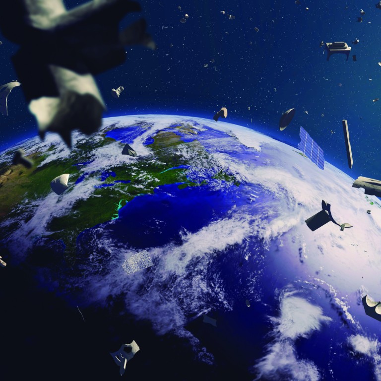
Space engineers’ biggest headaches come from debris between 1cm (0.4 inches) and 10cm because satellites can be given protection from smaller items while larger objects can be detected using existing technology with enough notice to take evasive action.
China needs Nasa, SpaceX hotline to avoid space collisions, scholar says
In 2016, one of the largest space-based radar systems owned by China lost 4 per cent of its power supply after a tiny piece of space junk, just over 1cm in length, hit the satellite’s solar panel, according to a report released last month.
High-power lasers can make these small pieces of debris change course and eventually fall back into the Earth’s atmosphere.
But the laser shots must land precisely and there is only a tiny margin of error – a matter of millimetres, according to Han’s team.
In a low-gravity environment, most debris rotates randomly, making identification and tracking more difficult so to overcome these challenges the team used an imaging technology that, according to a counter-intuitive theory in optical physics, does not result in a decrease in resolution when the distance increases.
The technology, known as laser reflection tomography, was inspired by the CAT scans used in hospitals and uses several laser beams to illuminate the target’s surface and then reconstructs the image from light particles bouncing in various directions.
The resolution on the images obtained using this method is determined by small differences in the angle of the laser beams when they hit the target, rather than the distance from the observer.
By improving the quality of the laser source and sensitivity of the receiving device, scientists could obtain ultra-sharp images of a tiny object from a long distance away.
The radar built by Han’s team fires short laser pulses with a peak power of over 100 kilowatts.

The machine’s actual performance in space surveillance remains classified, but the researchers revealed part of its potential in a ground experiment.
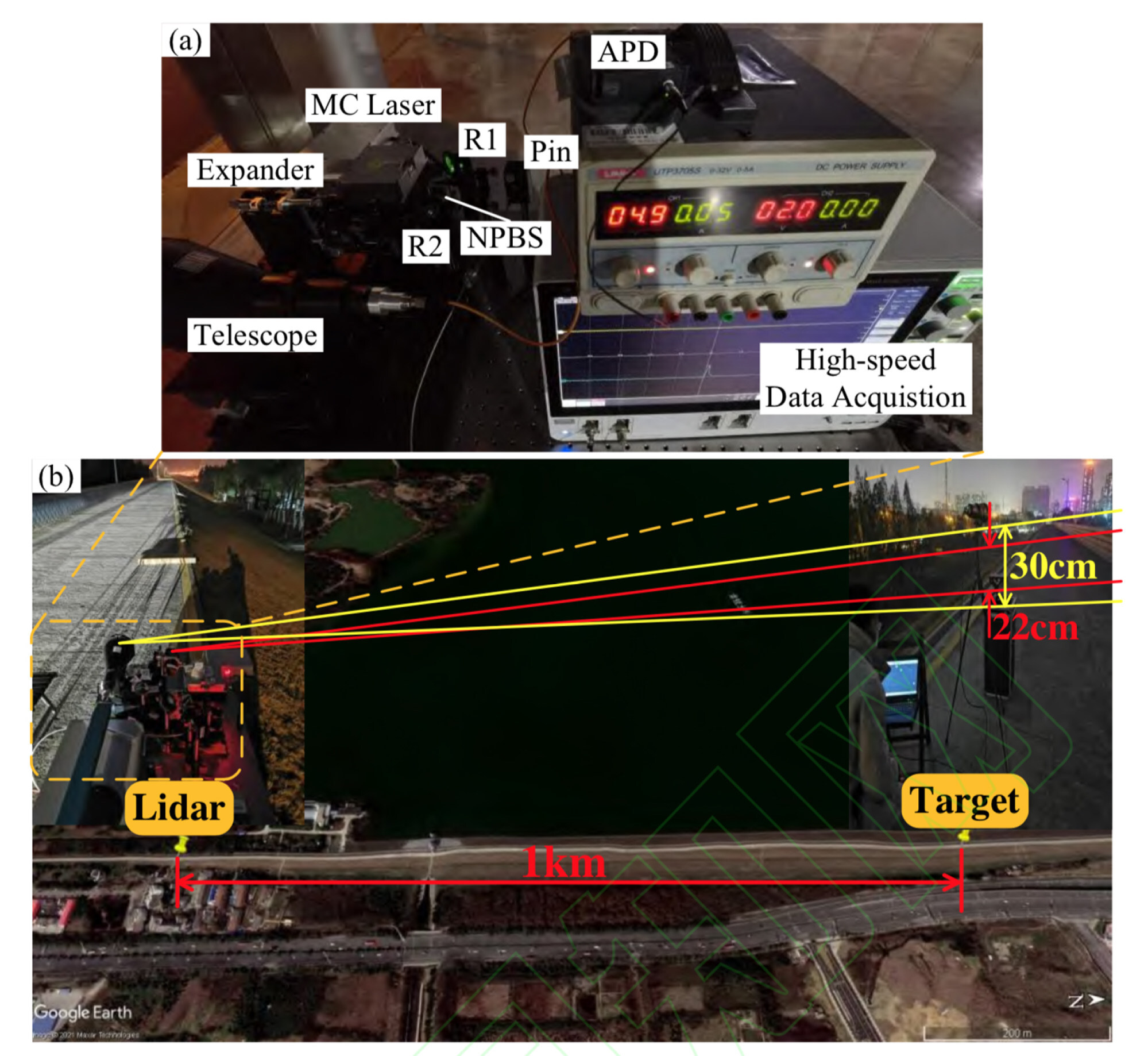
The device, mounted on the bank of a reservoir in a suburban area of Hefei city produced sharp images of a 5cm wide, rotating target a kilometre (0.6 miles) away.
The results provided a solid proof to the device’s potential to be used in space according to a researcher with the Chinese Academy of Sciences’ Xian Institute of Optics and Precision Mechanics who was not involved in the project but familiar with the technology.
“A major challenge to the quality of laser imaging technology is turbulence in the atmosphere,” said the researcher who requested not to be named due to the sensitivity of the technology.
China aims to break 2021 space launch record, looks at crew orbit first
The disturbance caused by turbulence within a horizontal, one kilometre range in Hefei was almost equivalent to that within an altitude of 100 kilometres, as the air becomes thinner higher up.
Beyond that there was little atmospheric effect because the laser would be travelling in space, according to the researcher.
The technology could be also used to study satellites to obtain valuable information about their design, technology, status and purpose, he added.
The technology used was first proposed by American scientists in the late 1980s and researchers around the world have been working to find ways to improve it.
Though a latecomer in this field, China has quickly caught up with some significant progress being achieved in recent years.
Han’s team said that their achievement was based on a cutting-edge laser source that significantly reduced the noise that affects signal quality.
They also developed a new algorithm using artificial intelligence to estimate the random movement of a small target and help the radar generate high quality images with incomplete, rapidly changing information.
In December, a research team at the Space Engineering University in Beijing said they had used a different type of laser imaging technology to achieve a resolution of 5mm from a distance of 1.2km.
The Chinese government announced a plan last year to build a defensive system with a number of cutting-edge facilities, including the world’s largest radar network and high-powered laser systems.

