Koppu coming soon: Philippines cancels flights, sends surfers packing as nation braces for what may be its 2nd-biggest typhoon of the year
Storm could turn into a super typhoon by the time it passes within 800km of Hong Kong on Wednesday
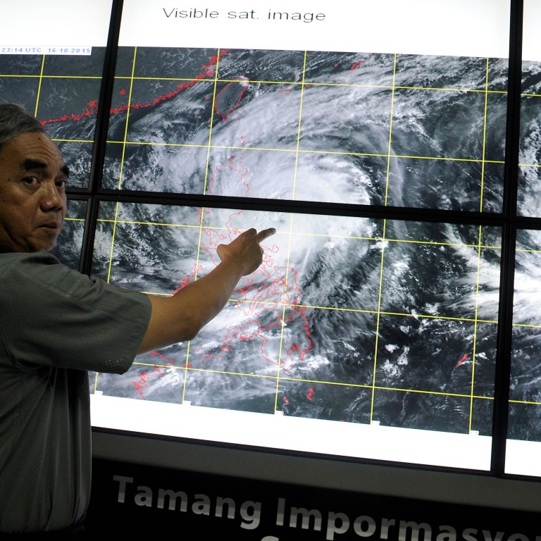
The Philippines is bracing for the full-force of a strengthening Typhoon Koppu, which may prove to be its second-strongest typhoon of the year, and landfall is expected within the next 24 hours.
Forecasters show Koppu is still intensifying and is likely to be upgraded to a Super Typhoon packing wind speeds of up to 195 km/h. The country is already preparing for flash floods and storm surges.
IN THE EYE OF THE STORM: A history of typhoons in Hong Kong
Philippine authorities cancelled flights and urged residents and tourists to move to safer ground on Saturday as Koppu approached northeastern parts of the main island of Luzon.
Disaster agency officials said about 300 hundred people living in vulnerable coastal or low-lying areas had already sought shelter due to the risk of floods, landslides and storm surges of up to 2 metres.
"We are asking 2,000 foreign and local tourists, most of them surfers, to abandon seaside resorts and go to safer areas," Gabriel Llave, a Baler municipal disaster official, told radio station dzMM.
Meanwhile, Hong Kong is in the grip of “severe” pollution warnings, the worst on the air quality scale, due to a dry continental airstream which is buffering Koppu as the storm crawls towards the Southeast Asian nation.
Temperatures on Saturday lunchtime soared as high as 32 degrees Celsius in Sham Shui Po, while the air quality index was “moderate” to “high.”
Philippine authorities on Saturday warned that Koppu will likely linger over the country for almost three days, bringing prolonged heavy rain, possible floods and sparking storm surges.
Koppu is likely to make landfall early Sunday and will not leave the archipelago until Tuesday, the government weather station said.
Weather station director Espie Cayanan said the storm, which has sustained winds of 160 kph, could strengthen as it gets closer to the archipelago nation.
Forecasters are warning of a “disaster” and possibly a “catastrophic” impact on the Philippines.
“A catastrophic flood scenario is looming over the Philippines as Typhoon Koppu intensifies and nears the island of Luzon,” warned Robert Speta, a meteorologist with Japanese broadcaster NHK World. He posted the comments on his westernpacificweather.com blog on Friday.
“The storm's intensity itself is one big issue with this system, but more so it is the extremely slow movement of Koppu that will result in over 48 hours of persistent rainfall across much of Luzon from Manila North,” Speta wrote.
“The big culprit is a large high pressure centred over southern China. This will act as a wall stopping Koppu as it starts to make landfall.”
Koppu is expected to fall within 800km of Hong Kong by Wednesday, triggering tropical cyclone advisory updates.
READ MORE: How typhoon Haiyan devastated the Phillippines just two years ago
The forecast for Hong Kong until Wednesday includes soaring air pollution levels and climes of up to 30 degrees Celsius.
In November 2013, Typhoon Haiyan brought a deadly 5-metre storm surge and wind speeds of around 195 km/h tore through low-lying areas of the Philippines, devastating areas including Tacloban.
Over 6,000 people were killed and nearly 2,000 people left on the missing list.

