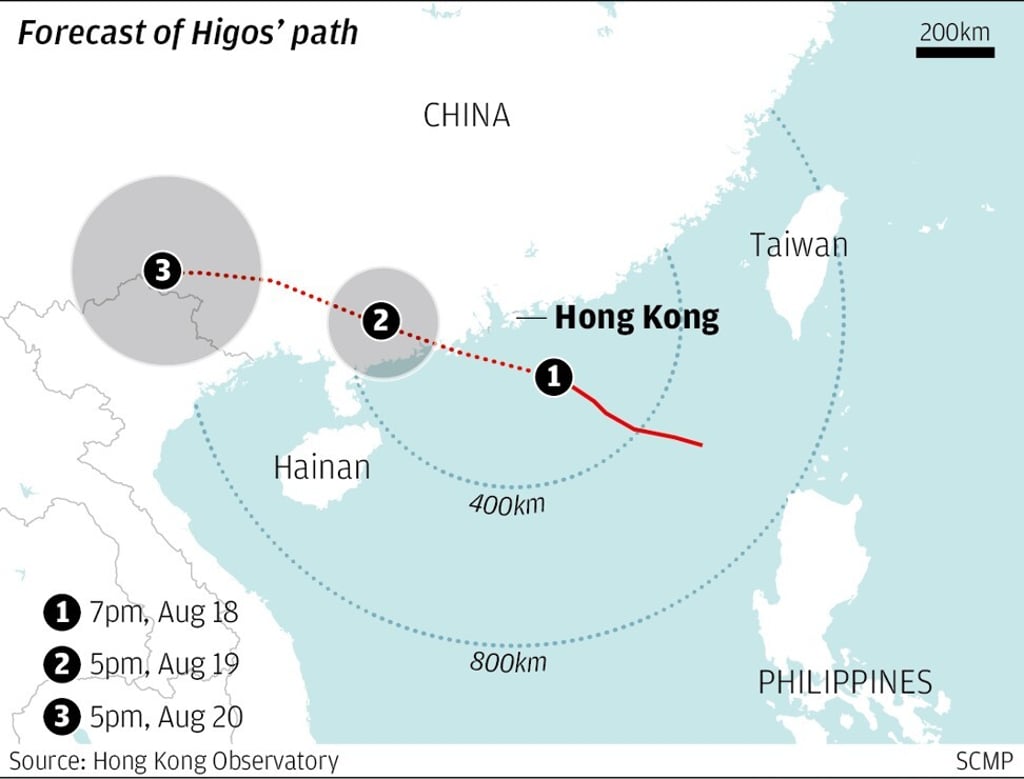
Typhoon signal lowered to No 8 as Higos begins moving away from Hong Kong
- The weather forecaster of Macau issues No 10 signal
- Wednesday likely to be windy with squally showers and thunderstorms

The Hong Kong Observatory downgraded the No 9 storm signal to No 8 at 7.40am on Wednesday as Typhoon Higos began to depart the city.
At 5am, the weather forecaster of Macau, which is just an hour from Hong Kong by ferry, issued the highest signal –No 10 – and said it will “remain in effect for a period of time”.
Intensifying winds resulted in the No 9 storm signal, the second-highest storm warning, being issued for Hong Kong at 1.30am on Wednesday.
The weather forecasters had earlier warned of a storm surge threatening low-lying areas of Hong Kong with flooding or a backflow of seawater by morning. High seas with swells were also expected.
At 5.45am, the Hong Kong Observatory issued a landslip warning, urging the public to stay away from steep slopes.
