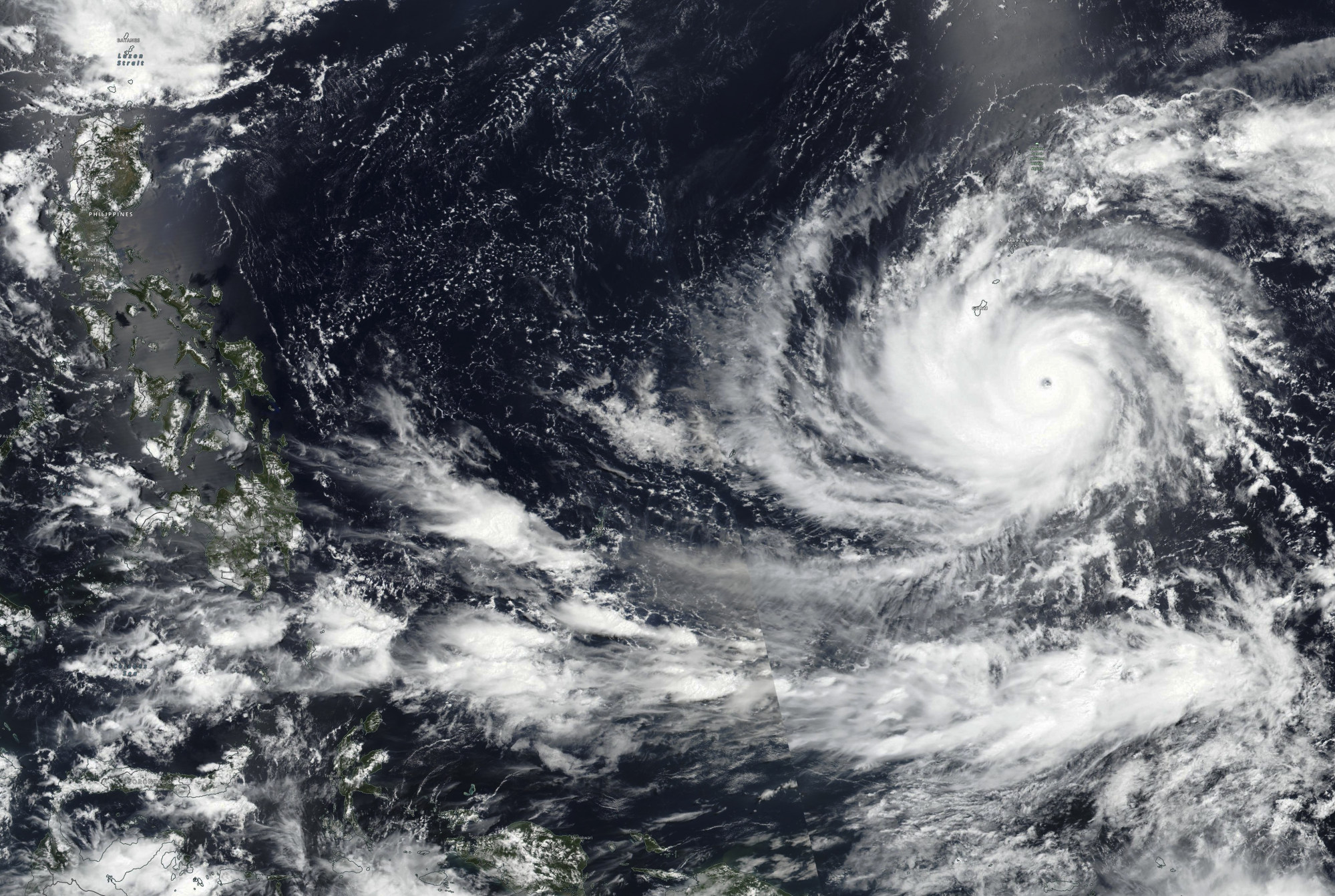
Hong Kong to swelter at 34 degrees Celsius early next week as region feels effects of Super Typhoon Mawar, city forecaster says
- China Meteorological Administration and Hong Kong Observatory both reclassify Typhoon Mawar as super typhoon
- ‘Its outer subsiding air will bring very hot weather to Guangdong early to midweek next week,’ city’s forecaster says
Hong Kong could swelter in temperatures of up to 34 degrees Celsius (93.2 Fahrenheit) from early next week due to a downward current of air associated with a super typhoon, the city’s weather forecaster has said.
The China Meteorological Administration and the Hong Kong Observatory on Tuesday afternoon reclassified Typhoon Mawar as a super typhoon, after it reached a sustained surface-wind strength of 240km/h (149mph).
“Super Typhoon Mawar, now over the western North Pacific, is expected to move towards the seas east of Luzon over the weekend,” the local forecaster said.
“Its outer subsiding air will bring very hot weather to Guangdong early to midweek next week.”
Hong Kong issues year’s first ‘very hot weather’ warning
A nine-day forecast showed the mercury next Tuesday could reach 34 degrees, the highest level recorded so far this year, while the weather would be “very hot with haze during the day”. The minimum temperature would be 27 degrees.
An automatic regional forecast for that day showed temperatures in Lau Fau Shan, Sheung Shui, Shek Kong and Ta Kwu Ling would climb to 36 degrees at about 2pm.
People headed outside on Friday for the Buddha’s Birthday public holiday can expect the mercury to reach between 27 and 31 degrees, with sunny periods and occasional showers during the day, the Observatory said.
“Under the influence of an anticyclone aloft, the weather will be generally fine and hot over the northern part of the South China Sea and the coastal areas of Guangdong in the next couple of days,” it added.

Mawar was headed towards Guam, a territory of the United States, on Wednesday at 2pm and had a maximum sustained wind speed of 185km per hour, with gusts of up to 260km/h.
The Joint Typhoon Warning Centre, a meteorological body under the US Navy and Air Force, said Mawar’s maximum sustained winds at one point that day reached 249km/h. A storm surge and torrential rainfall were also reported.
Mawar had a wind speed equal to that of a Category 4 on the Saffir-Simpson hurricane wind scale, which could result in the loss of roof structures and exterior walls, severe damage to well-built framed homes, downed power lines and uprooted trees, it said.
‘Extreme weather events’: Asia set for supercharged heat as El Nino looms
The World Meteorological Organization said last week global temperatures would likely surge to record levels in the next five years, fuelled by heat-trapping greenhouse gases and naturally occurring El Nino events warming the central and east-central Pacific Ocean.
El Nino events refer to the warming of the ocean surface, or when they reach above-average sea surface temperatures.
US forecasters have warned that Mawar, named after the Malaysian word for rose, was moving over abnormally warm water in the Pacific as it intensified. It was expected to bring a more severe storm surge, inland flooding and rainstorms of up to 50.8cm (20 inches).
