Official Hong Kong transport info app HKeMobility rolled out, but key data from MTR and other major operators not included
Transport Department launches new platform for journey planning, but some information from rail giant and major bus companies KMB and Citybus is noticeably absent
Key data from Hong Kong’s biggest transport operators was conspicuously absent from a new mobile application rolled out by city officials on Tuesday to help commuters plan journeys.
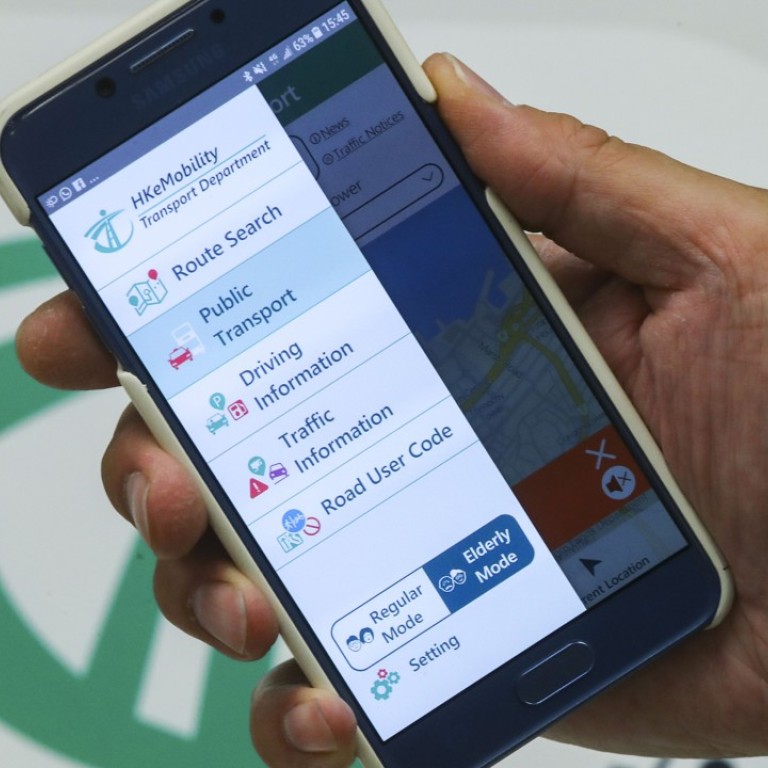
HKeMobility features information ranging from arrival times for buses and availability of parking spaces to the best routes for the visually impaired.
But arrival times for services run by major players KMB, New World First Bus, Citybus and rail operator the MTR were not included.
The app, which is an amalgamation of the Transport Department’s existing mobile platforms, HKeTransport, HKeRouting and eTraffic News, was only displaying arrival times for trams, and buses run by New Lantao Bus Company.
For information on other operators, users need to tap once more to switch to the companies’ own apps. This comes despite the government being the largest shareholder in the MTR Corporation.

“We consider the information to be private assets and they have the right to protect those assets,” said Michael Law Hing-sun, a chief engineer at the department’s smart mobility division.
The app cost about HK$600,000 (US$76,500) to develop and is part of government plans to improve urban management and quality of life under a blueprint for a “smart city”.
Want to get around Hong Kong in the fastest time possible? Transport app Citymapper launches in city
Real-time parking vacancy information from about 220 car parks – more than 10 per cent of the total number in Hong Kong – has been included.
For pedestrians, the best walking routes in Causeway Bay and Tsim Sha Tsui are available.
Officials said they had conducted on-site inspections in these two districts to map out the best routes for people with special needs.

Visually impaired users can find advice on routes with traffic lights, to make crossing the road easier. Bridges not installed with lifts are excluded from recommendations for those with mobility problems.
The department said walking routes covering all districts would be available in two or three years.
The app would collect information on user behaviour, officials added, to improve transport planning in the future. But they stressed that personal information would not be collected and none would be handed to law enforcement agencies.
Francis Fong Po-kiu, honorary president of the Hong Kong Information Technology Federation, said officials should get all transport operators to share their data with the government as well as private companies, as a condition for renewing their operating licences.
Open data was a key part of building a “smart city”, he said.

