'Phantom island' riddle solved, says New Zealand researcher
A New Zealand researcher on Monday claimed to have solved the riddle of a mystery South Pacific island shown on Google Earth and world maps which does not exist, blaming a whaling ship from 1876.

A New Zealand researcher on Monday claimed to have solved the riddle of a mystery South Pacific island shown on Google Earth and world maps which does not exist, blaming a whaling ship from 1876.
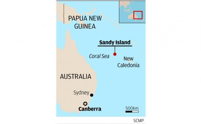
The Times Atlas of the World appears to identify it as Sable Island, but according to Australian scientists who went searching last month during a geological expedition it could not be found.
Intrigued, Shaun Higgins, a researcher at Auckland Museum, started investigating and claimed it never existed, with a whaling ship the source of the original error.
“As far as I can tell, the island was recorded by the whaling ship the Velocity,” Higgins told ABC radio, adding that the ship’s master reported a series of “heavy breakers” and some “sandy islets”.
“My supposition is that they simply recorded a hazard at the time. They might have recorded a low-lying reef or thought they saw a reef. They could have been in the wrong place. There are a number of possibilities,” he said.