Why Hong Kong’s spectacular outdoor scenery has taken Instagrammers’ breath away
- Popular sites in Hong Kong’s scenic countryside, from Tai Lam Country Park to ‘Thousand-Island Lake’, have risen to social media fame
- Autumn and winter foliage and breathtaking coastal landscapes in Lai Chi Chong and Tap Mun offer inspiration for nature-loving netizens
Many of the spectacular scenic sites in Hong Kong’s unspoiled countryside have become social media sensations in recent years. Netizens have been amazed that a sea-flanked area of islands and rolling hills, covering only about 1,114 sq km, boasts such a diverse range of natural landscapes.
From browsing online photographs, they have learned about the locations offering the best vantage points for great images while hiking along popular trails in country parks, prompting many to visit these locations in person.
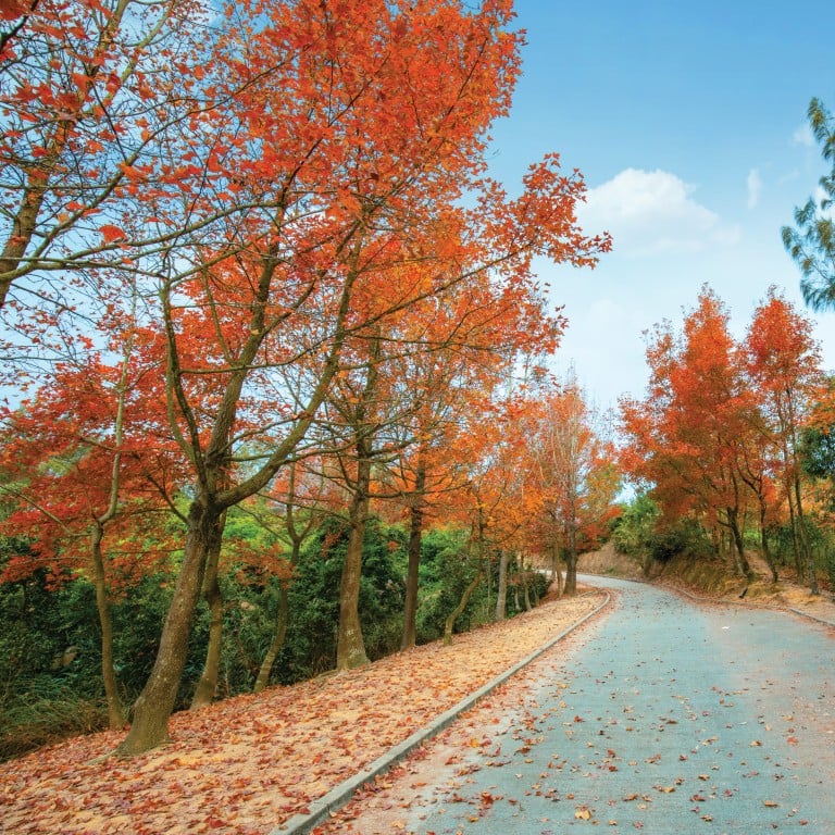
Fiery-coloured foliage captivates in Tai Lam Country Park
Vibrantly coloured autumn and winter tree foliage is a phenomenon that many people associate with the woodlands of North America, but Hong Kong’s nature lovers can enjoy the same stunning vistas by easily making their way to Tai Lam Country Park in Western New Territories.
During the city’s colder months, Sweet Gum Woods becomes one of the city’s most Instagrammable destinations. Visitors flock to the area to capture images as the leaves on the eponymous trees, as well as Chinese tallow, turn from bright yellow to fiery orange and crimson red as part of their annual colour-changing ritual.
There are a few other tree species that are worth paying attention to in the area. Hong Kong Gordonia is a native shrub known for its large white flowers that bloom in winter. From March to April, the white blossoms of Grantham’s Camellia, a protected species, take their turn to shine, while the red bell-like flowers of Rhodoleia also bloom during these months.
The walk up there, along Tai Tong Shan Road, is not so challenging, making it suitable for most people. The main woodland area in the park stretches for about 400 metres, providing numerous opportunities for new Instagram-worthy images.

Many hikers like to come to Tai Lam Country Park for another of its not-to-be-missed spots for Instagrammers: Reservoir Islands Viewpoint – a hilltop looking out towards Tai Lam Chung Reservoir, nicknamed “Thousand-Island Lake”. It was created within a valley, containing many small hills, not long after the second world war. When the main dam was built, water began to accumulate, resulting in a blue-coloured lake dotted with islets.
From up there you can see the tops of all these irregular islets jutting out from the lake, which is how it gets its name. With your camera carefully angled at the right spot, you can take a photograph so that it seems as if you have the Thousand-Island Lake right beneath your feet.
Lai Chi Chong’s geological coastal wonders …
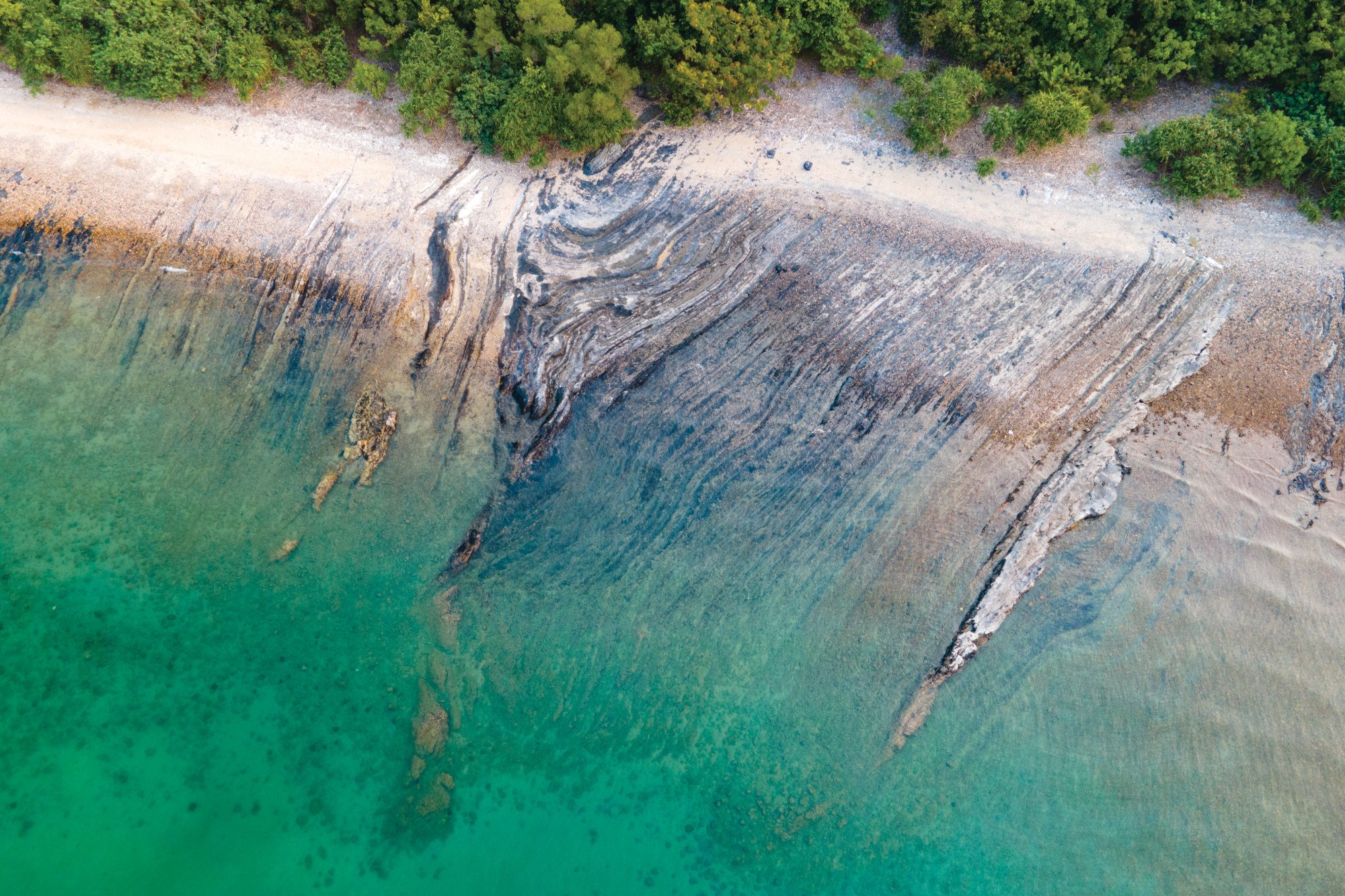
Images of Hong Kong’s craggy coastlines and dramatic headlands have also attracted many social media “likes”, especially those taken within Hong Kong Unesco Global Geopark.
This 150 sq km area of land and sea in the northeast of the city contains many notable geological sites, including Lai Chi Chong, on the southeast coast of Tolo Channel, in Sai Kung West Country Park.
The region features complex geological structures and varied rock formations that include Late Jurassic volcanic sedimentary rocks and other sedimentary rocks, as well as tuff – a relatively porous rock usually formed from compacted volcanic ash and dust.

You can reach this site by taking the circular kaito ferry from Ma Liu Shui Pier, near the MTR University Station, which connects various villages around the area. Right after you get off the boat at Lai Chi Chong, you will see a sign indicating the start of the geotour hiking route, which is estimated to take one hour each way. An illustrated map offers details of the types of rocks you can expect to see along the way.
The experience is best described as a “geological cake shop” because, as you stroll along the coast, you will come across a kaleidoscope of patterns. You first see marble cake-like tuffites – rocks containing volcanic fragments – mini-faults (horizontally rolled-up layers of rock) that resemble mille-feuilles, and then, at the midpoint, a boulder field, which looks like a platter of plain chocolate truffles. The walk also features rocks patterned with quartz veins, folded siltstone sedimentary rocks and, at the end, a pebble beach.

… and Tap Mun’s fishing village charms
If you catch the westbound kaito again, it will take you to the island of Tap Mun, which is home to a charming old fishing village. When making this trip during the breeding season in July and August, you are likely to see flocks of migratory terns tailing the boat as it sails across the water.
Right off the pier is the island’s “commercial centre”, Tap Mun Hoi Pong Street, where you will find village stores and restaurants. Seafood can be seen drying in the air by the road, alongside villagers’ displays of finished products for sale.

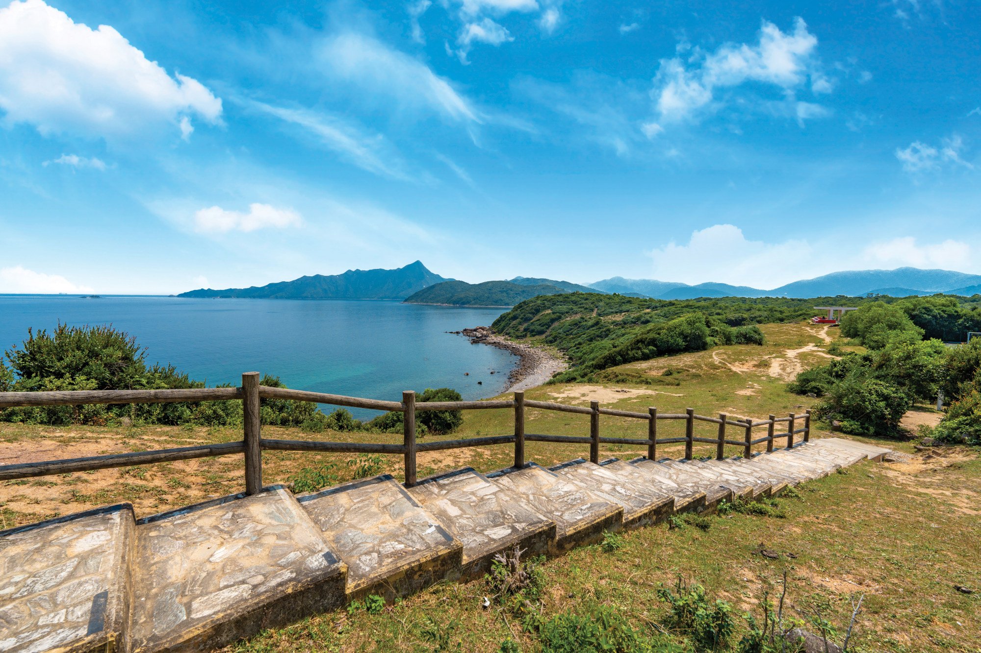
The coastline along the southern part of the island offers a moderate and scenic hike. You may start by heading up the steps beside the 400-year-old Tin Hau Temple to reach Tap Mun Sitting-out Area, which comprises the Hilltop Pavilion and an expansive meadow. This offers the best vantage point on the island for taking stunning photographs. You can use the unobstructed view of Mirs Bay as a backdrop and, on a clear day, even see Dapeng Peninsula in mainland China.

The well-maintained trail continues along the coast, making a U-shape at the southern tip of the island before reaching New Fishermen’s Village. Here you can stop to take Instagram-worthy pictures of Sai Kung West Country Park across the water and the eye-catching public playground with stepped seating decorated with colourful murals.
With its many unspoiled rolling hills, mountains and valleys, hundreds of islands and craggy coastlines, Hong Kong continues to surprise many visitors as an unparalleled destination offering exhilarating experiences and reinvigorating outdoor pursuits.

