Source:
https://scmp.com/lifestyle/travel-leisure/article/2122051/how-hike-cheung-chau-without-crowds-guide-hong-kongs Travel & Leisure
How to hike Cheung Chau without the crowds: a guide to Hong Kong’s dumbbell island
Away from the busy harbour there is plenty to explore on tiny Cheung Chau for those who like to walk. We take you on an anti-clockwise tour of the island’s best sights, which can all be seen in a matter of hours

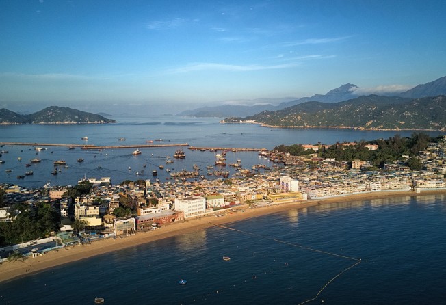
Tung Wan beach runs along the central lowland part of Cheung Chau. This is where you want to start your hike. Photo: Martin Williams
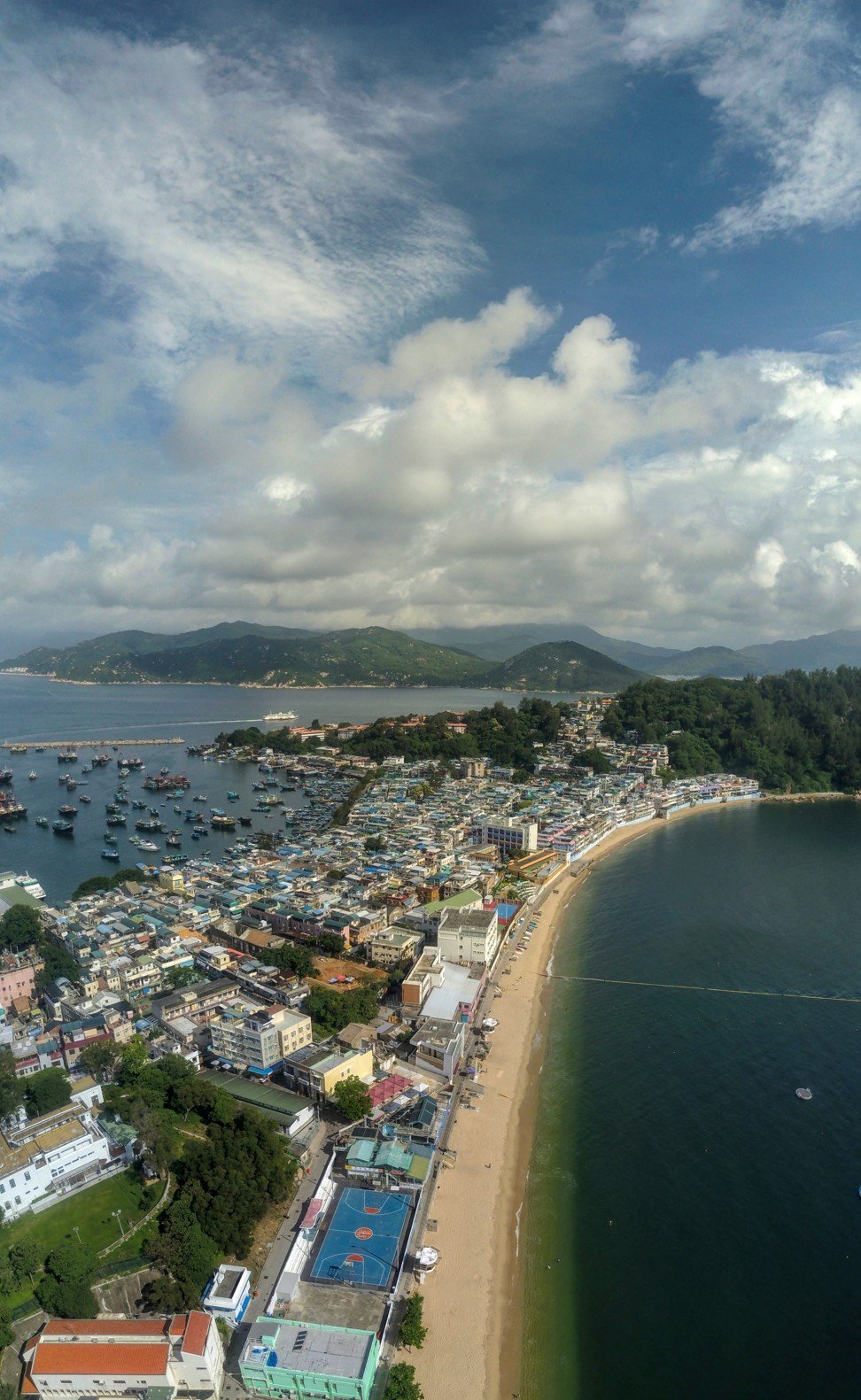
When you step off the ferry on Cheung Chau – a small, dumbbell-shaped island off the southwest coast of Hong Kong’s Lantau Island – you will likely find crowds comparable to those of Mong Kok’s Ladies Market. What few visitors realise, however, is that you only have to walk a little before the crowds thin out and you can find pleasant stretches of trail and lovely quieter areas.
First, head to the main beach at Tung Wan. As you come off the ferry pier, turn right and then promptly left, continuing in that direction until you hit the beach. You’ll pass stores selling knick-knacks for tourists, an old banyan tree with small shrines at its base, a pub, and shops selling food and drink.
Beyond the northern end of the beach, Cheung Chau is hilly, with a headland sheltering the bay; to the south it is hilly, too. The central part of the island with the pier and beach is a low strip of land – geologically, this is known as a tombolo, and it is this area that is packed with housing for much of the island’s 23,000 inhabitants.
Now you have an idea of the layout of the island, you’re ready to start exploring. Head south first.
The Mini Great Wall
A path running alongside Tung Wan beach leads you below the Warwick Hotel, then past an ancient rock carving and a windsurfing centre to a smaller beach at Kwun Yam Wan. Here, the path turns up a wooded slope. Left at a junction, and soon left again, and a path climbs the slope south of the bay. There are some grand views over Cheung Chau, with Lantau’s hills beyond.
From a lookout pavilion, steps drop down towards the “Mini Great Wall”, which is actually a footpath made from marble-like blocks.
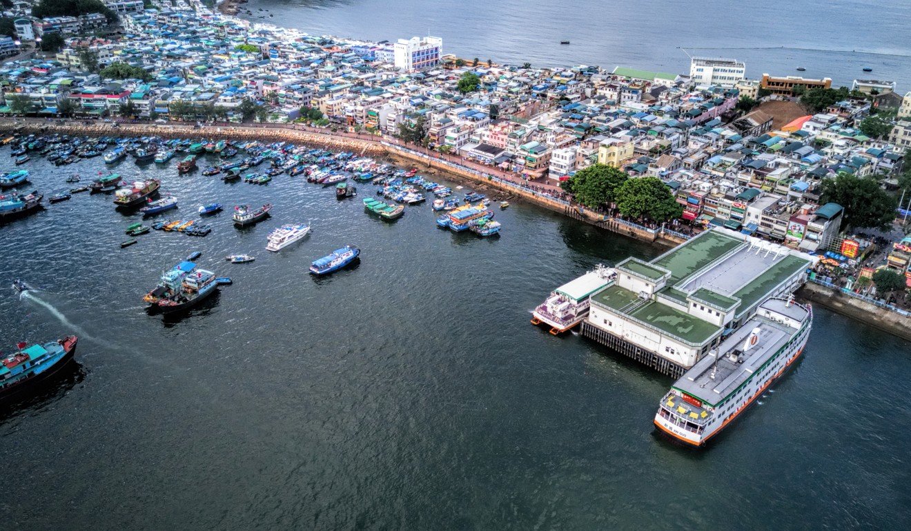
The main ferry pier on Cheung Chau. Photo: Martin Williams
A short flight of steps goes down to Vase Rock, which is a fine looking, natural granite sculpture on top of a coastal crag. There are more naturally sculpted rocks along the path, often given fanciful names.
Elephant Rock does look like an elephant, from the right angle. And it’s easy to see why the largest and most distinctive of the rocks is called Human Head Rock, especially if you crouch and shuffle to its northern side.
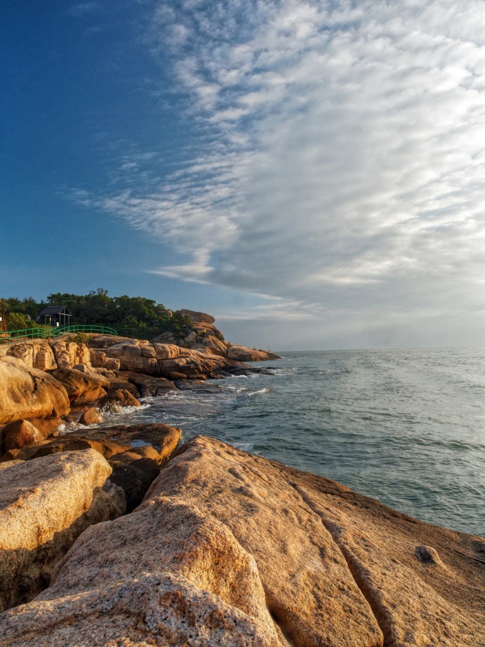
Southwards, the “great wall” ends atop a headland with views of Cheung Chau’s wild southeast coast, with Lamma Island and Hong Kong Island to the east, and the island of Wailingding, in Zhuhai, to the south.
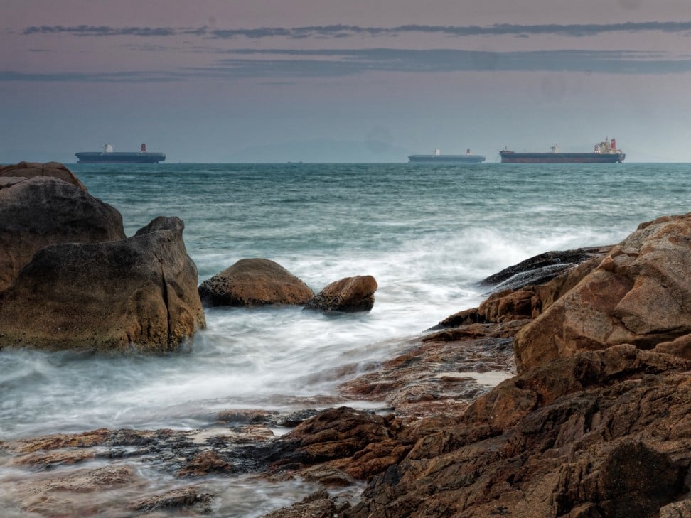
Ships off Nam Tam Wan on southern Cheung Chau. Photo: Martin Williams
Peak Road via Nam Tam Wan
Most people who reach this point simply retrace their steps back towards the beaches. But there is more exploring to be done, up steps from near the Human Head Rock.
These steps start at the Mini Great Wall and climb to the top of the east-facing hillside, reaching a junction where you can turn left and walk along a trail well above the coast. The trail passes between trees and bamboo and there is a tiny glade amid casuarinas where you can take a side trail to see a ruined house.
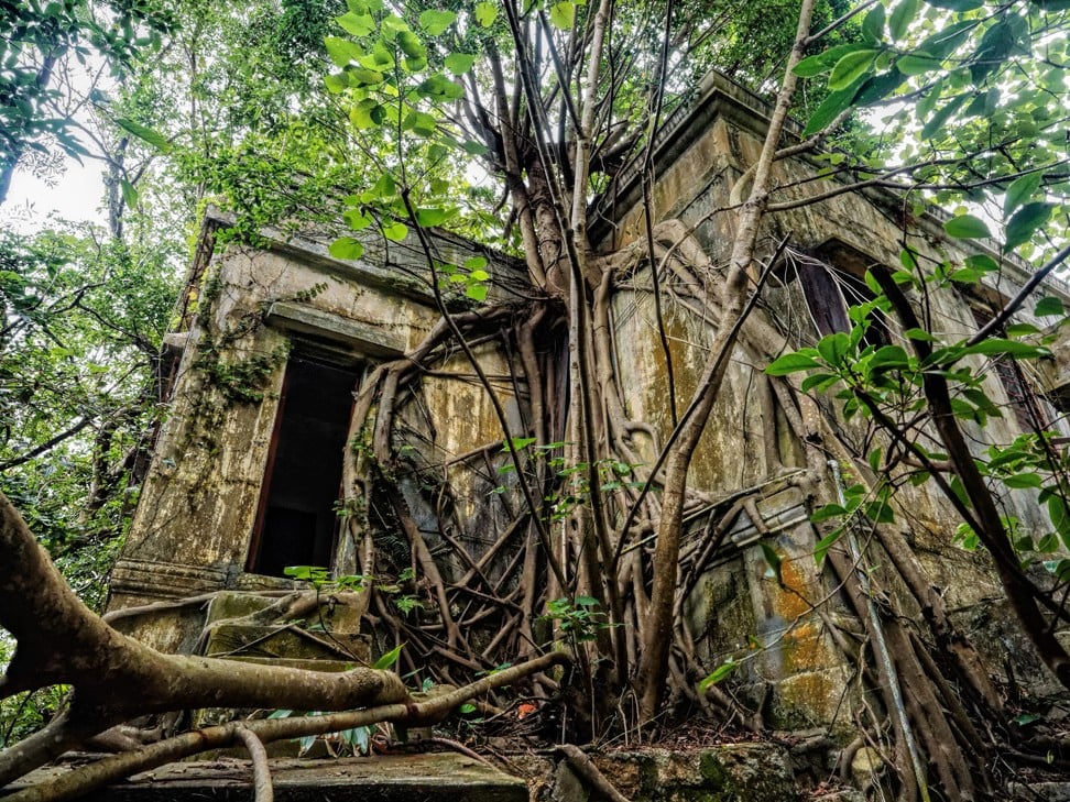
An old ruined house in southeast Cheung Chau. Photo: Martin Williams
Along the main path, and left after a housing compound, there are more coastal views. Go left again, past a headland, and turn on to a path winding down to a small bay called Nam Tam Wan. There’s a picturesque cove of coarse sand here, barely the length of a badminton court. Walking above this mini beach, you might notice the area on the right still bears signs of the storm surge from Severe Typhoon Hato from August this year.
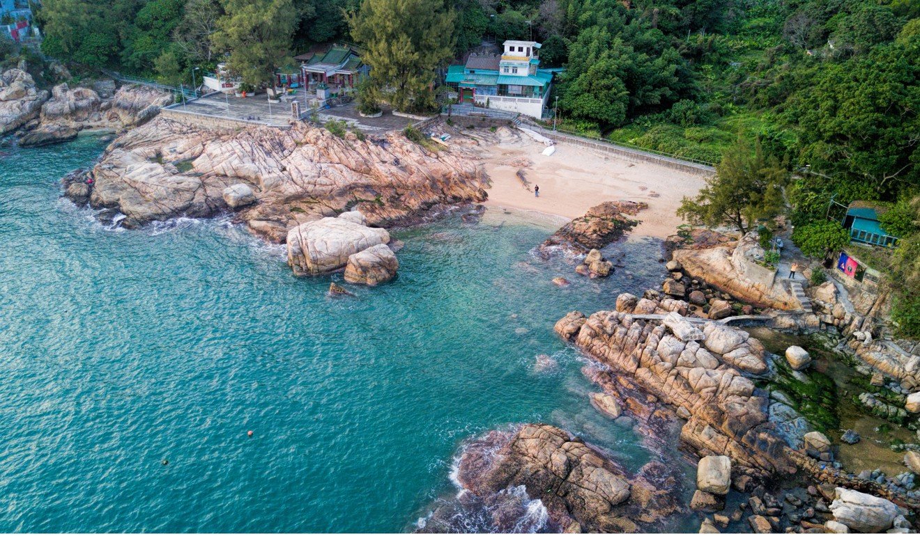
Nam Tam Wan with its Tin Hau temple in the background. Photo: Martin Williams
There is a Tin Hau temple set back just enough from the shore that it was spared Hato’s wrath. The path then climbs a little and reaches some houses before arriving at Peak Road, which is little more than a footpath. Take another left turn, as our anti-clockwise tour continues.
Cheung Chau’s scenic southwest
Peak Road leads between houses at the southern fringe of the main residential area before a gentle uphill stretch takes walkers into more woodland. Heading down again towards the southwest corner of Cheung Chau takes you to a large cemetery. This might not seem in keeping with the rest of the walk, but look for a left turn and you can stroll to Italian Beach – as Western residents have dubbed it – otherwise known as Pak Tso Wan.
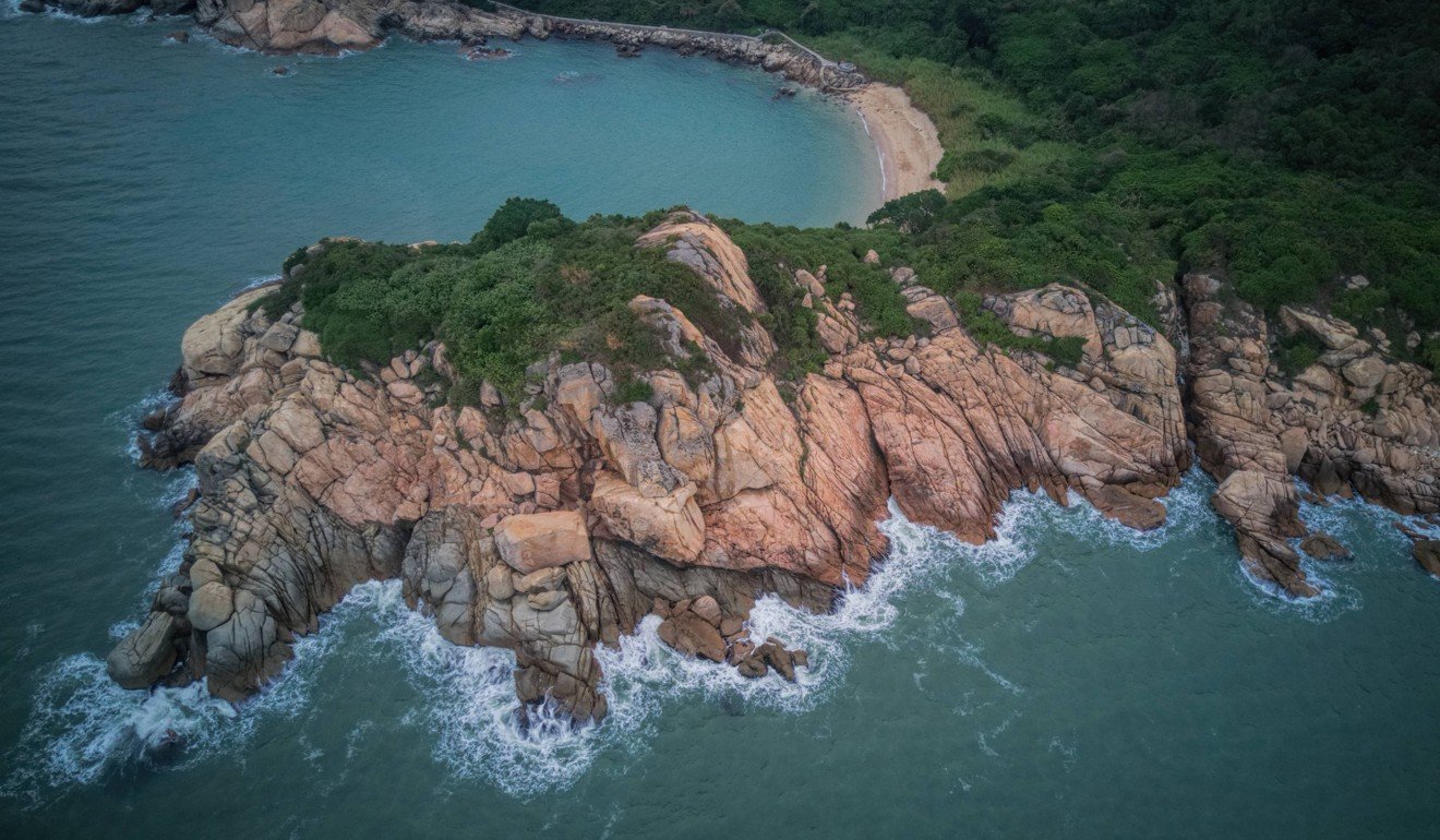
The Italian Beach area, also known as Pak Tso Wan. Photo: Martin Williams
This beach is remote (at least by Cheung Chau standards) and is cradled between rocky headlands with green slopes behind, making it a pleasant spot to linger. Westwards, a path makes for the top of a headland, where a short walk leads to Reclining Rock – a pair of immense boulders overhanging the rocky slope.
Straight on is a tiny inlet, where the path disappears for a while. Unless there is a really high tide it is easy to cross the rocks and sand before returning to the concrete trail that is built here over bare granite.
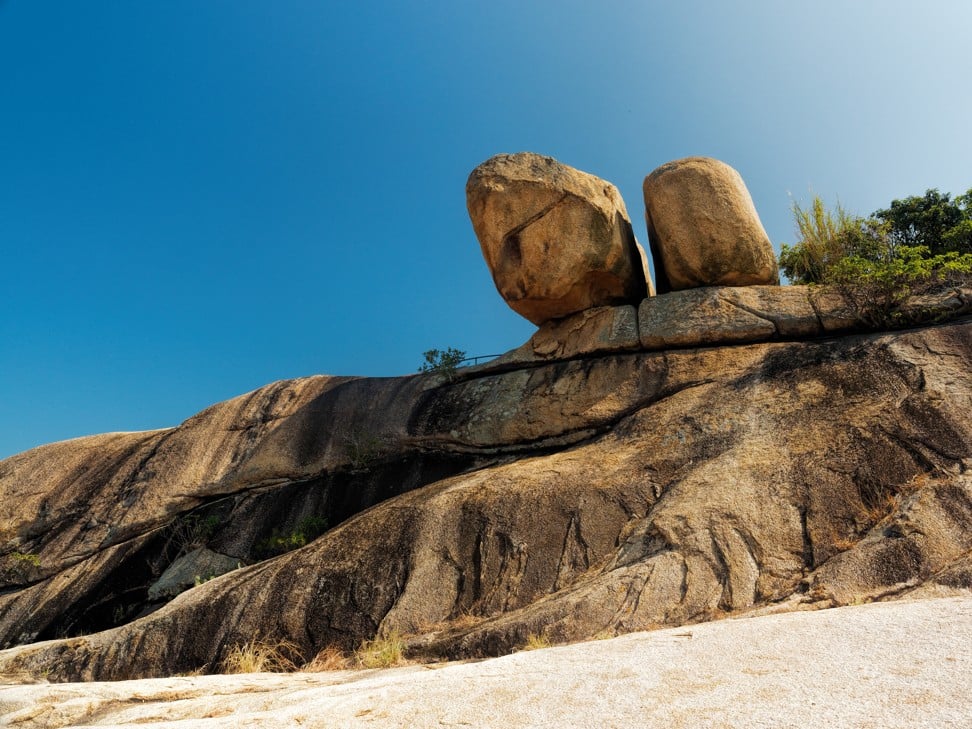
Reclining Rock is actually a pair of boulders overhanging a rocky slope. Photo: Martin Williams
Soon the path leaves the shore through a cleft in the granite and goes up steps between a jumble of giant boulders. At the top, you can turn left if you want down to Cheung Po Tsai Cave, named after the famous 19th century pirate – but while there is a folk myth about the pirate storing booty here, there is, however, no real evidence he even visited. The “cave” is just a dark gap further down, between more huge boulders.
You might want to give that a miss and head right at the top instead, down more steps to Cheung Chau’s main Tin Hau temple. This one looks out across the harbour and the breakwaters that provide fishing boats more practical protection against typhoons.
South of Po Yue Wan near Cheung Po Tsai Cave. Photo: Martin Williams
Village interlude
From the harbour, sampans shuttle across the water to beside the main ferry pier. It’s a scenic ride, but you can instead choose to keep on walking. Avoid the waterfront road, which is popular with pedestrians and cyclists, and instead look for a path on the right, just after a tiny harbour.
The path angles up the hillside through dense trees. There is a quiet, compact village with small bungalows arranged in rows on a hillside, then a verdant valley with a stream below an old pavilion. Afterwards, the path leaves the hills and circles back to the main village. This might be a good time to explore the warren of village streets and perhaps stop for a meal at a restaurant.
Tung Wan beach in central Cheung Chau. Photo: Martin Williams
There are several cafes serving set lunches with fried rice, Hong Kong-style curries and more. But visitors should try one of the budget seafood restaurants along the harbourfront north of the pier. So Bor Kee on Pak She Praya Road, for example, offers a selection of spicy dishes by chefs from Hunan province.
Then, if you have time and energy – the route so far might have taken three hours, or more if you’ve stopped to take photos and rest – north Cheung Chau awaits.
The northern hills and a tucked-away beach
From the main ferry pier, walk north by the harbour, passing a row of restaurants, before leaving the main village and walking up and over to the northwest coast. A couple of beaches at Siu Kwai Wan and then Tai Kwai Wan face Lantau, across a narrow channel plied by ferries.
The slender Cheung Pak Road curls up the hillside to a sitting-out area where the painted concrete seats below a small pavilions seem designed for hosting busloads of visitors, even though only a smattering of people hike this far.
There is a lookout pavilion on top of the hill, which is a fine vantage point for admiring Cheung Chau: the belt of housing between beach and harbour, and the southern hills and headlands beyond. Below, flights of steps lead down a windswept headland, then to a secluded beach, seemingly far from the madding crowds.
Sadly, like many Hong Kong beaches, this one is prone to arrivals of wave-borne rubbish like plastic bottles and chunks of polystyrene. Unlike gazetted swimming beaches, there is no daily clean-up service. But at least views of the surroundings, and out through the inlet towards Hong Kong Island, are pleasant.
Steps from the north end of the beach arrive at a rough track, where you might turn right towards the very north of the island. If you’d rather call it a day, walk left past a pavilion, below which is a path that heads towards the main village. A flight of steps ends by the temple to Pak Tai, the northern king.
Getting there
Cheung Chau is reached by ferries from pier 5 at the Central Ferry Piers (nwff.com.hk).