
Satellites to track Chinese dams on Mekong river, as US likens ‘threat’ facing Southeast Asia to South China Sea
- The US-funded Mekong Dam Monitor will track water levels at 11 Chinese dams along the river, where Washington has blamed droughts on China
- Increased transparency is a boost for downstream countries, but many are wary of one more move in the great power competition

US claims China’s ‘manipulation’ of Mekong is ‘urgent challenge’ for Southeast Asia
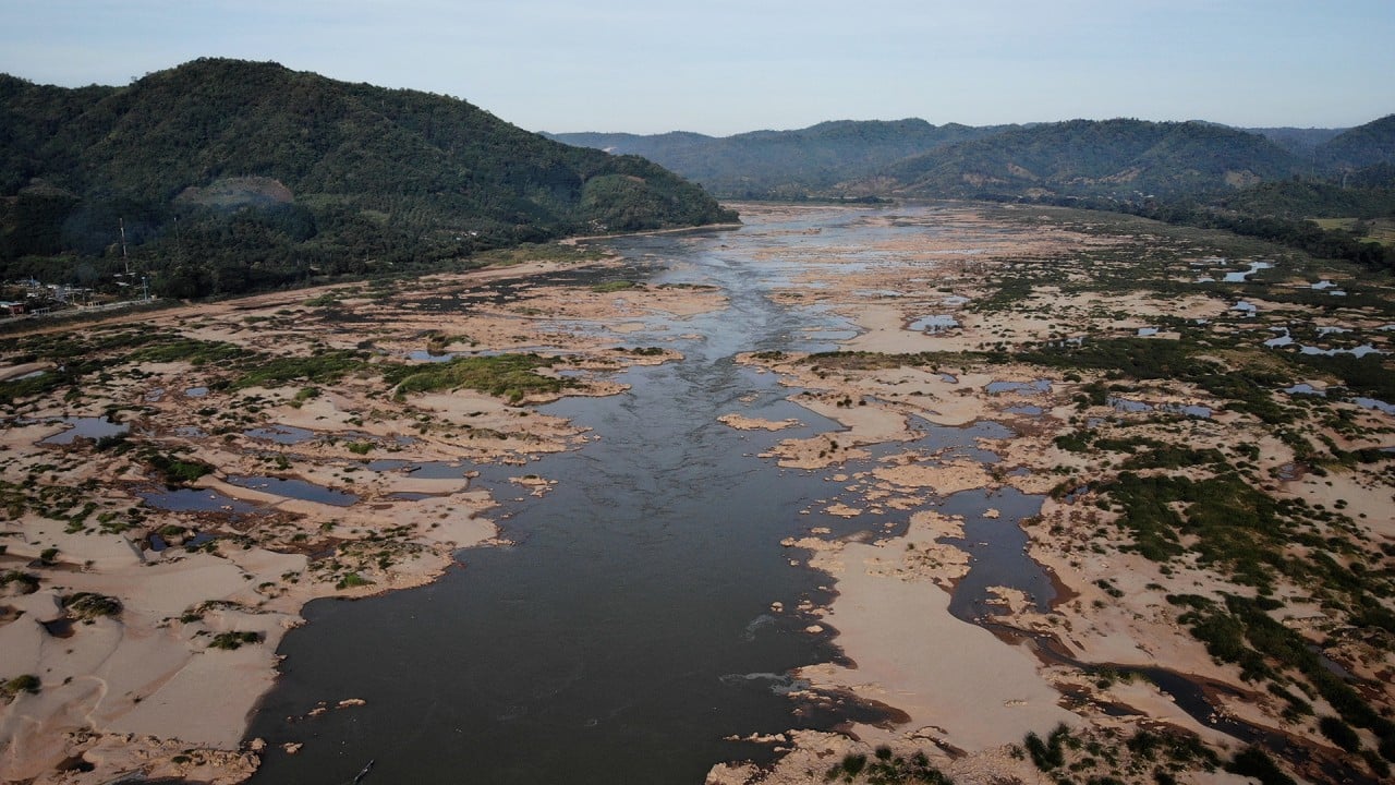
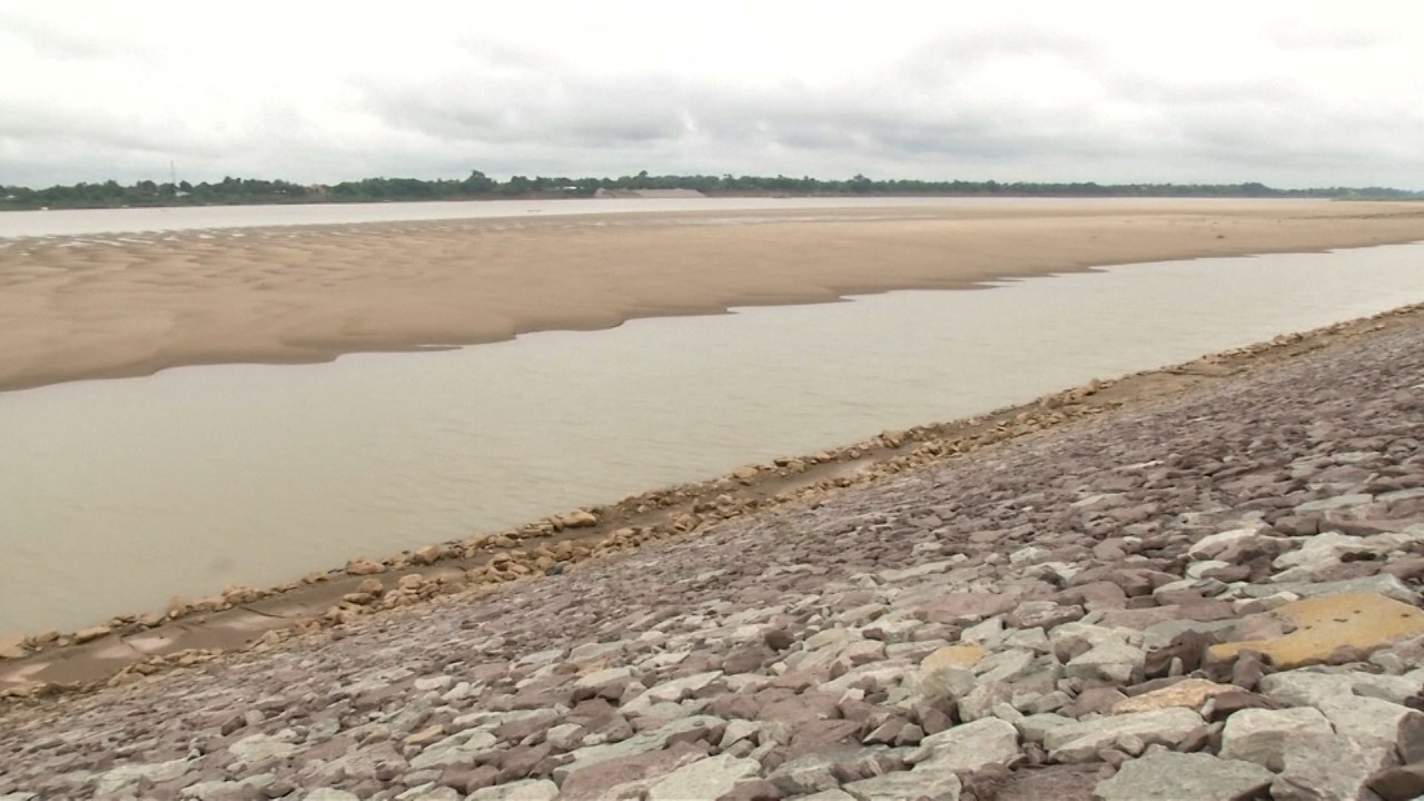
He said satellite imagery of Tonle Sap, a freshwater lake in Cambodia, from April to August this year had revealed not only unusually low water levels for the season but also a 90 per cent reduction in fish catches.
The monitor is an open-source online platform that will provide weekly updates using remote sensing and satellite imagery on the levels of reservoirs at 13 Chinese dams along the Mekong’s main stretch, as well as at 15 tributary dams.
It will also circulate weekly visualisations and analysis of China’s 11-dam cascade on the upper Mekong, as well as maps and data on temperature, snow cover, precipitation and other indicators along the river’s full course, according to its website.
02:31
Have China’s dams been drying up the Mekong River or is low rainfall to blame?
The collaborative project from the Washington-based Stimson Center think tank’s Southeast Asia programme and Eyes On Earth – a US research and consulting company specialising in water – comes after years of frustrations from countries along the river at China’s lack of transparency with such information.
The launch of the US initiative, described by Stilwell as evidence of US commitment to the region, follows the launch of a similar Chinese initiative in early November. The Lancang-Mekong Water Resources Cooperation Information Sharing Platform was launched with a pledge by Beijing to share year-round hydrological data. Previously Beijing had only publicised flood season information.
Calling on Mekong countries to press China for even more information, Stilwell said data provided by Beijing was limited in scope and did not provide details such as upstream dam operations that Mekong countries needed to know to manage agriculture and other industries.
The 4,350km Mekong emerges in China – where it is known as the Lancang River – before running through Cambodia, Laos, Thailand, Myanmar and Vietnam.
While Asean countries have their own competing claims in the South China Sea, the bloc has for years addressed the topic on a joint basis by reaffirming the importance of maintaining peace, security, stability as well as safety and freedom of navigation.
Treat Mekong droughts like South China Sea – through Asean: ex-diplomat
“We encourage Asean to develop a common position on the Mekong Basin as it has since 2012 on the South China Sea,” Stilwell said. “Threats to Asean unity rising from the Mekong Region are no less existential.”
While China reacted with little enthusiasm to the launch of the monitor, many regional analysts and activists welcomed the US initiative, saying any efforts to increase transparency would benefit Southeast Asian countries whose livelihoods and ecology had been affected by China’s upstream dam activities.
STUCK IN THE MIDDLE
Asked about the monitor at a daily news conference on Monday, Chinese foreign ministry spokesperson Wang Wenbin said China and other Mekong countries had in recent years overcome external “noise and interference” to boost cooperation on water resources.
China welcomed constructive advice on water resources but “resolutely opposes malicious provocation”, Wang added.
Welcoming the launch, Vannarith Chheang, president of Asian Vision Institute, an independent think tank based in Phnom Penh, said information sharing and transparency were crucial in building trust and coming up with “data-driven solutions”.
03:02
China’s Mekong ambitions cause concern for Thai locals
However, the platform ought to stay away from geopolitical intentions and narratives, Chheang said.
“Over-securitisation and over-politicisation of the Mekong River are harmful to regional cooperation. The initiative should be genuinely technical so that it will contribute to the sustainable management of the Mekong River,” added Chheang.
Thitinan Pongsudhirak, a political-science professor at Thailand’s Chulalongkorn University said the monitor’s launch reinforced the US resistance to China in the Mekong region.
“It is likely to intensify the superpower rivalry and broaden it from the South China Sea to mainland Southeast Asia,” Pongsudhirak said.
Pongsudhirak added that the lower Mekong countries welcomed Washington’s engagement not just because of Beijing’s “inexorable dominance” in the Mekong due to its upstream leverage, but also because Chinese hydrological data gathering and sharing had “been viewed with downstream scepticism”.
The next US-China battleground: Chinese dams on the Mekong River?
In a written reply, the Mekong River Commission (MRC) Secretariat said once information on the amount of water storage in the entire Mekong was made available, it would be “very useful” in helping to develop flood and drought mitigation options, adding that earth observation and satellite information were important in complementing the commission’s ground monitoring and data sharing efforts.
Pointing to the importance of downstream countries in providing data and making recommendations, the secretariat said the monitor should support and complement current and planned cooperative efforts by MRC member countries in jointly managing and developing the basin.
“Member countries should be engaged in the further development of the tool in order to enhance cooperation and avoid any misunderstanding,” the secretariat said.
Sebastian Biba, a visiting fellow of the Foreign Policy Institute at the Johns Hopkins University School of Advanced International Studies, said while the new data provided by the monitor could lead to greater knowledge and transparency that could be beneficial for managing the Mekong, the initiative came from the US, “an external player not on good terms with China as the Mekong’s hydro-hegemon”.
01:21
Droughts, hydroelectric dams deplete Mekong River despite arrival of rainy season
The timing was also “conspicuous”, coming at a time of US-China great power competition, Biba said.
“Given the overall climate between the US and China, there may be a danger that data could become instrumentalised,” said Biba, the author of a book on China’s hydro-politics in the Mekong.
He said China was likely to reject some of the monitor’s data and the friction could increase distrust among stakeholders and negatively affect regional cooperation.
Biba said downstream countries and communities could be caught in the middle of this great power competition, “and what looks advantageous today could well turn into a disaster tomorrow”.
“My hunch is that regional stakeholders should not push the envelope with China too much by leaning too closely towards the US. This is not least because I strongly doubt that the US has the willingness and resources to effectively counter Chinese influence in the region in the long run,” Biba added.
And while there was potential for cooperation with the MRC, the monitor was also likely to “precipitate a further marginalisation” of the commission, especially if the new initiative turned out to cooperate more with the newly established US-Mekong Partnership.
Nguyen Minh Quang, Vietnam’s Can Tho University lecturer and co-founder of the Mekong Environment Forum (MEF), said the short-term impact of the Stimson project was that it could amplify the voices of and empower non-state actors, such as NGOs and grass roots movements, in local green politics.
Based in Vietnam’s Mekong Delta, the MEF was formed in response to public concerns about how mainstream dams along the Mekong would impact water and food security, and the livelihoods of millions of people in downstream communities.
