Hong Kong issues No 1 typhoon warning signal as storm Ma-on edges closer to city
- Signal issued at 9.10pm with forecaster expecting it to remain in force at least until 6am on Wednesday
- Many districts experience maximum temperatures above 34 degrees, while air pollution at 15 monitoring stations classed as ‘high risk’ for health

The Hong Kong Observatory issued the typhoon No 1 warning signal on Tuesday evening as Severe Tropical Storm Ma-on edged within 800km of the city.
The signal was issued at 9.10pm and the forecaster said it was expected to remain in force at least until 6am on Wednesday.
At 10pm, Ma-on or saddle in Cantonese, was estimated to be about 740km east-southeast of Hong Kong and was forecast to move northwest or west-northwest at about 22km/h across the northeastern part of the South China Sea and in the general direction of the coast of western Guangdong.
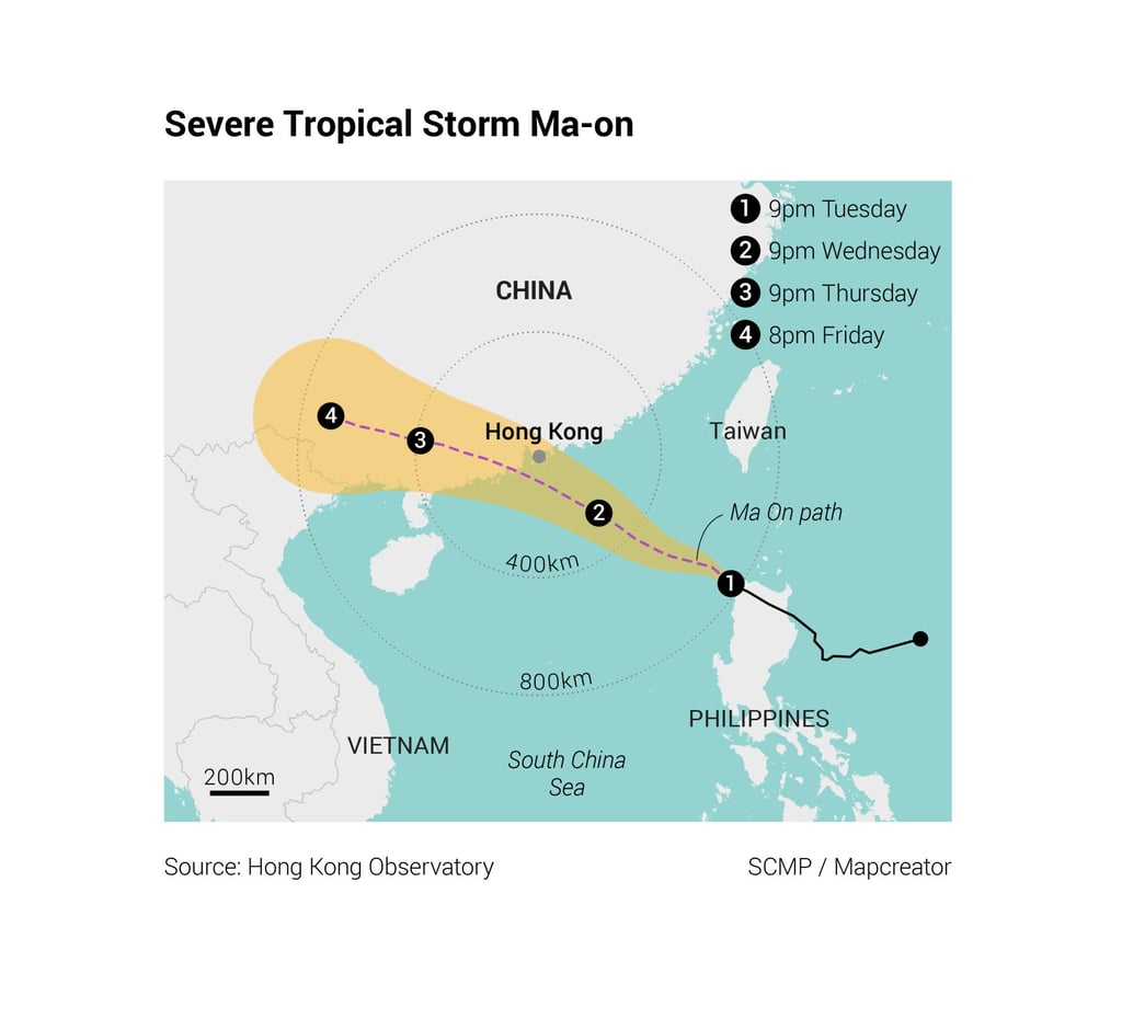
Ma-on would maintain a distance of over 500km from Hong Kong on Tuesday night and the next morning, according to the Observatory, which added local winds would not strengthen significantly.
Under the subsidence associated with Ma-on, it will be very hot on Wednesday with squally showers and thunderstorms. As the storm moved towards the coast of Guangdong, local winds were expected to strengthen on Wednesday night.